IMAGES TAKEN NEAR TO
Tattysallagh Road, OMAGH, BT78 4RQ
Introduction
This page details the photographs taken nearby to Tattysallagh Road, BT78 4RQ by members of the Geograph project.
The Geograph project started in 2005 with the aim of publishing, organising and preserving representative images for every square kilometre of Great Britain, Ireland and the Isle of Man.

There are currently over 7.5m images from over14,400 individuals and you can help contribute to the project by visiting https://www.geograph.org.uk
Image Map
Images are licensed for reuse under creativecommons.org/licenses/by-sa/2.0
Notes
- Clicking on the map will re-center to the selected point.
- The higher the marker number, the further away the image location is from the centre of the postcode.
Image Listing (12 Images Found)
Images are licensed for reuse under creativecommons.org/licenses/by-sa/2.0
Image
Details
Distance
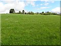
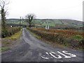
1
An open field, Cornavarrow
Pictured along Tattysallagh Road
Image: © Kenneth Allen
Taken: 28 May 2013
0.03 miles
2
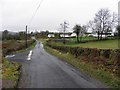
Tattysallagh Road, Cornavarrow
Heading west
Image: © Kenneth Allen
Taken: 5 Apr 2011
0.03 miles
4
Cornavarrow Townland
Looking south from Tattysallagh Road
Image: © Kenneth Allen
Taken: 28 May 2013
0.08 miles
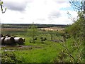
5
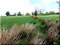
Rushes and whins, Cornavarrow
Looking northwards
Image: © Kenneth Allen
Taken: 28 May 2013
0.10 miles
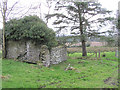
6
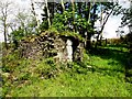
Ruined farm building
Pictured along Tattysallagh Road
Image: © Kenneth Allen
Taken: 28 May 2013
0.11 miles
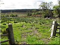
7
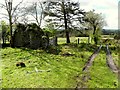
Ruined cottage, Cornavarrow
Pictured along Tattysallagh Road
Image: © Kenneth Allen
Taken: 28 May 2013
0.12 miles
9
Abandoned cottage
It is at Cornavarrow between Dromore and Drumquin.
Image: © Kenneth Allen
Taken: 7 Feb 2006
0.14 miles
10
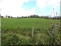
A green field, Cornavarrow
Pictured along Tattysallagh Road
Image: © Kenneth Allen
Taken: 28 May 2013
0.17 miles