IMAGES TAKEN NEAR TO
Carnkenny Road, OMAGH, BT78 4LW
Introduction
This page details the photographs taken nearby to Carnkenny Road, BT78 4LW by members of the Geograph project.
The Geograph project started in 2005 with the aim of publishing, organising and preserving representative images for every square kilometre of Great Britain, Ireland and the Isle of Man.

There are currently over 7.5m images from over14,400 individuals and you can help contribute to the project by visiting https://www.geograph.org.uk
Image Map
Images are licensed for reuse under creativecommons.org/licenses/by-sa/2.0
Notes
- Clicking on the map will re-center to the selected point.
- The higher the marker number, the further away the image location is from the centre of the postcode.
Image Listing (34 Images Found)
Images are licensed for reuse under creativecommons.org/licenses/by-sa/2.0
Image
Details
Distance
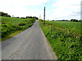
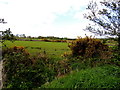
1
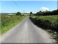
Carnkenny Road, Milltown
Heading north
Image: © Kenneth Allen
Taken: 1 Jul 2014
0.08 miles
2
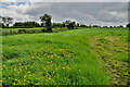
Buttercups in a field, Carnkenny
Pictured along Carnkenny Road
Image: © Kenneth Allen
Taken: 19 May 2022
0.08 miles
3
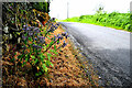
Borage plant along Carnkenny Road
Borage, also known as a starflower pictured at Carnkenny
It seems to have survived a herbicide application along the roadside
Image: © Kenneth Allen
Taken: 19 May 2022
0.08 miles
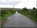
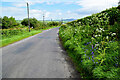
5
Carnkenny Road
Heading SSW at Carnkenny
Image: © Kenneth Allen
Taken: 16 May 2018
0.08 miles
7
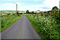
Carnkenny Road, Kilstrule
Heading NNE towards Carnkenny
Image: © Kenneth Allen
Taken: 19 May 2022
0.09 miles
8
Carnkenny Road, Carnkenny
Heading NNE
Image: © Kenneth Allen
Taken: 19 May 2022
0.11 miles
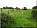
9
Kilstrule Townland
Looking west from Hill Road
Image: © Kenneth Allen
Taken: 16 May 2018
0.12 miles
10
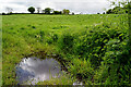
Water lying in field, Kilstrule
Pictured along Carnkenny Road
Image: © Kenneth Allen
Taken: 19 May 2022
0.12 miles