IMAGES TAKEN NEAR TO
Brocklis Road, OMAGH, BT78 4LS
Introduction
This page details the photographs taken nearby to Brocklis Road, BT78 4LS by members of the Geograph project.
The Geograph project started in 2005 with the aim of publishing, organising and preserving representative images for every square kilometre of Great Britain, Ireland and the Isle of Man.

There are currently over 7.5m images from over14,400 individuals and you can help contribute to the project by visiting https://www.geograph.org.uk
Image Map
Images are licensed for reuse under creativecommons.org/licenses/by-sa/2.0
Notes
- Clicking on the map will re-center to the selected point.
- The higher the marker number, the further away the image location is from the centre of the postcode.
Image Listing (24 Images Found)
Images are licensed for reuse under creativecommons.org/licenses/by-sa/2.0
Image
Details
Distance
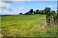
1
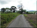
Brocklis Road
Heading south-east at Ardstraw
Image: © Kenneth Allen
Taken: 3 Jun 2014
0.00 miles
2
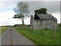
Ruined farm building along Brocklis Road
Heading north-west
Image: © Kenneth Allen
Taken: 3 Jun 2014
0.04 miles
3
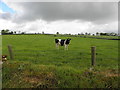
Cow, Ardstraw
One of several in a field along Brocklis Road
Image: © Kenneth Allen
Taken: 3 Jun 2014
0.05 miles
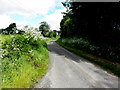
4
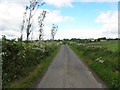
Brocklis Road, Ardstraw
Heading north-west
Image: © Kenneth Allen
Taken: 3 Jun 2014
0.07 miles
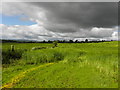
5
An open field, Ardstraw
Pictured along Brocklis Road
Image: © Kenneth Allen
Taken: 13 Aug 2019
0.11 miles
6
Brocklis Road
Bending north-west at Ardstraw
Image: © Kenneth Allen
Taken: 3 Jun 2014
0.11 miles
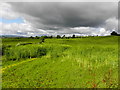
8
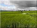
Darkening sky, Ardstraw
It rained shortly after this - I took a break and had a coffee.
Image: © Kenneth Allen
Taken: 3 Jun 2014
0.12 miles
10
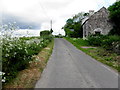
Brocklis Road, Ardstraw
Heading WNW
My attention was drawn to the building on the right Image]
Image: © Kenneth Allen
Taken: 3 Jun 2014
0.15 miles