IMAGES TAKEN NEAR TO
Liscabble Road, OMAGH, BT78 4EF
Introduction
This page details the photographs taken nearby to Liscabble Road, BT78 4EF by members of the Geograph project.
The Geograph project started in 2005 with the aim of publishing, organising and preserving representative images for every square kilometre of Great Britain, Ireland and the Isle of Man.

There are currently over 7.5m images from over14,400 individuals and you can help contribute to the project by visiting https://www.geograph.org.uk
Image Map
Images are licensed for reuse under creativecommons.org/licenses/by-sa/2.0
Notes
- Clicking on the map will re-center to the selected point.
- The higher the marker number, the further away the image location is from the centre of the postcode.
Image Listing (18 Images Found)
Images are licensed for reuse under creativecommons.org/licenses/by-sa/2.0
Image
Details
Distance
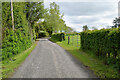
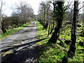
1
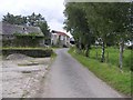
Liscabble Road
Heading west at Moyle Glebe
Image: © Kenneth Allen
Taken: 6 Aug 2009
0.03 miles
2
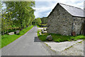
Stone walled barn, Moyle Glebe
Heading east on Liscabble Road
Image: © Kenneth Allen
Taken: 26 May 2021
0.03 miles
3
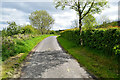
Bend along Liscabble Road
Heading ENE at Moyle Glebe
Image: © Kenneth Allen
Taken: 26 May 2021
0.04 miles
4
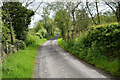
Liscabble Road, Moyle Glebe
Heading east
Image: © Kenneth Allen
Taken: 26 May 2021
0.07 miles
5
Liscabble Road
Heading north-east at Moyle Glebe
Image: © Kenneth Allen
Taken: 26 May 2021
0.07 miles
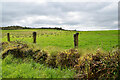
7
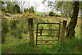
Rusty gate, Moyle Glebe
Pictured along Liscabble Road
Image: © Kenneth Allen
Taken: 26 May 2021
0.09 miles
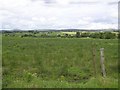
8
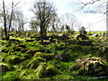
Trees and rocks, Moyle Glebe
Pictured along Liscabble Road
Image: © Kenneth Allen
Taken: 20 Apr 2015
0.10 miles
10
Grey skies, Moyle Glebe
Conditions were dull this morning but it was sunny later on
Image: © Kenneth Allen
Taken: 26 May 2021
0.13 miles