IMAGES TAKEN NEAR TO
Feglish Road, OMAGH, BT78 3UD
Introduction
This page details the photographs taken nearby to Feglish Road, BT78 3UD by members of the Geograph project.
The Geograph project started in 2005 with the aim of publishing, organising and preserving representative images for every square kilometre of Great Britain, Ireland and the Isle of Man.

There are currently over 7.5m images from over14,400 individuals and you can help contribute to the project by visiting https://www.geograph.org.uk
Image Map
Images are licensed for reuse under creativecommons.org/licenses/by-sa/2.0
Notes
- Clicking on the map will re-center to the selected point.
- The higher the marker number, the further away the image location is from the centre of the postcode.
Image Listing (4 Images Found)
Images are licensed for reuse under creativecommons.org/licenses/by-sa/2.0
Image
Details
Distance
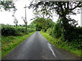
1
Kinine Townland
These stone-built pillars must have been at the entrance to some grand house at a time, but there is no evidence of a building.
Image: © Kenneth Allen
Taken: 27 Feb 2007
0.07 miles
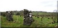
2
Road at Kinine
The puddles remain for several days.
Image: © Kenneth Allen
Taken: 6 Mar 2007
0.07 miles
3
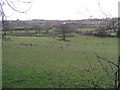
Kinine Townland
A patchwork of fields.
Image: © Kenneth Allen
Taken: 6 Mar 2007
0.12 miles