IMAGES TAKEN NEAR TO
Crossan Road, OMAGH, BT78 3TW
Introduction
This page details the photographs taken nearby to Crossan Road, BT78 3TW by members of the Geograph project.
The Geograph project started in 2005 with the aim of publishing, organising and preserving representative images for every square kilometre of Great Britain, Ireland and the Isle of Man.

There are currently over 7.5m images from over14,400 individuals and you can help contribute to the project by visiting https://www.geograph.org.uk
Image Map
Images are licensed for reuse under creativecommons.org/licenses/by-sa/2.0
Notes
- Clicking on the map will re-center to the selected point.
- The higher the marker number, the further away the image location is from the centre of the postcode.
Image Listing (20 Images Found)
Images are licensed for reuse under creativecommons.org/licenses/by-sa/2.0
Image
Details
Distance
1
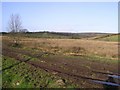
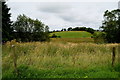
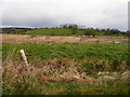
Derrygany Townland
Contrasting colours in the landscape.
Image: © Kenneth Allen
Taken: 20 Feb 2007
0.03 miles
2
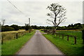
Bends on Crossan Road, Shanmullagh East
Heading east
Image: © Kenneth Allen
Taken: 27 Jul 2019
0.03 miles
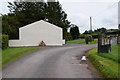
3
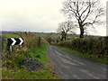
Mullagh Road, Shanmullagh East
Heading south from Crossan School
Image: © Kenneth Allen
Taken: 27 Jul 2019
0.03 miles
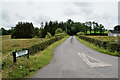
4
Mullagh Road, Shanmullagh East
Heading south from Crossan Road
Image: © Kenneth Allen
Taken: 15 Apr 2015
0.04 miles
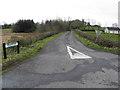
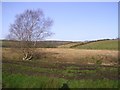
5
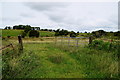
Rough ground, Shanmullagh East
Pictured along Crossan Road
Image: © Kenneth Allen
Taken: 27 Jul 2019
0.04 miles
6
Crossan Road, Shanmullagh East
Heading ENE
Image: © Kenneth Allen
Taken: 27 Jul 2019
0.05 miles
7
Mullagh Road
Heading NNE at Shanmullagh
Image: © Kenneth Allen
Taken: 15 Apr 2015
0.07 miles
8
Shanmullagh East / Drumardnagross
Pictured along Crossan Road
Image: © Kenneth Allen
Taken: 27 Jul 2019
0.10 miles
9
Shanmullagh East
Pictured along Crossan Road
Image: © Kenneth Allen
Taken: 15 Apr 2015
0.11 miles
10
Derrygany Townland
A similar view to before, but looking to the north.
Image: © Kenneth Allen
Taken: 20 Feb 2007
0.12 miles