IMAGES TAKEN NEAR TO
Castlehill Road, OMAGH, BT78 3TL
Introduction
This page details the photographs taken nearby to Castlehill Road, BT78 3TL by members of the Geograph project.
The Geograph project started in 2005 with the aim of publishing, organising and preserving representative images for every square kilometre of Great Britain, Ireland and the Isle of Man.

There are currently over 7.5m images from over14,400 individuals and you can help contribute to the project by visiting https://www.geograph.org.uk
Image Map
Images are licensed for reuse under creativecommons.org/licenses/by-sa/2.0
Notes
- Clicking on the map will re-center to the selected point.
- The higher the marker number, the further away the image location is from the centre of the postcode.
Image Listing (8 Images Found)
Images are licensed for reuse under creativecommons.org/licenses/by-sa/2.0
Image
Details
Distance
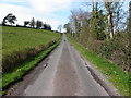
1
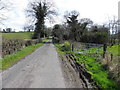
Castlehill Road, Shanmullagh
Heading WSW
Image: © Kenneth Allen
Taken: 15 Apr 2015
0.07 miles
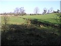
2
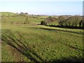
Drumbinnion Townland
Still long shadows cast over the fields.
Image: © Kenneth Allen
Taken: 20 Feb 2007
0.13 miles
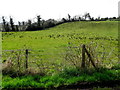
4
Shanmullagh Townland
Looking NNW from Castlehill Road
Image: © Kenneth Allen
Taken: 15 Apr 2015
0.14 miles
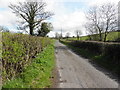
5
Castlehill Road
Heading ENE at Shanmullagh
Image: © Kenneth Allen
Taken: 15 Apr 2015
0.16 miles
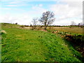
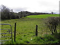
6
Drumbinnion Townland
Looking northwards.
Image: © Kenneth Allen
Taken: 20 Feb 2007
0.16 miles
7
Castlehill Road
Heading ENE at Kennogue
Image: © Kenneth Allen
Taken: 15 Apr 2015
0.20 miles
8
Kennogue Townland
Looking south-east from Castlehill Road
Image: © Kenneth Allen
Taken: 15 Apr 2015
0.22 miles