IMAGES TAKEN NEAR TO
Gargadis Road, OMAGH, BT78 3TF
Introduction
This page details the photographs taken nearby to Gargadis Road, BT78 3TF by members of the Geograph project.
The Geograph project started in 2005 with the aim of publishing, organising and preserving representative images for every square kilometre of Great Britain, Ireland and the Isle of Man.

There are currently over 7.5m images from over14,400 individuals and you can help contribute to the project by visiting https://www.geograph.org.uk
Image Map
Images are licensed for reuse under creativecommons.org/licenses/by-sa/2.0
Notes
- Clicking on the map will re-center to the selected point.
- The higher the marker number, the further away the image location is from the centre of the postcode.
Image Listing (27 Images Found)
Images are licensed for reuse under creativecommons.org/licenses/by-sa/2.0
Image
Details
Distance
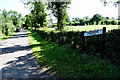
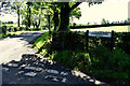
1
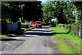
Royal mail van, Gargadis
Pictured along Gargadis Road
Image: © Kenneth Allen
Taken: 8 Aug 2020
0.03 miles
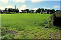
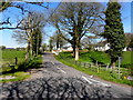
2
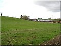
Farm buildings at Gargalis
The buildings blend into the side of the hill.
Image: © Kenneth Allen
Taken: 20 Feb 2007
0.05 miles
3
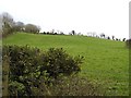
Gargalis
The blooms of the whin bushes never disappeared .
Image: © Kenneth Allen
Taken: 20 Feb 2007
0.05 miles
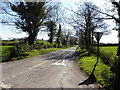
4
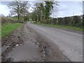
Road at Gargalis
The location is to the north of Kilskeery.
Image: © Kenneth Allen
Taken: 20 Feb 2007
0.05 miles
5
Gargadis Townland
Pictured along Gargadis Road
Image: © Kenneth Allen
Taken: 8 Aug 2020
0.06 miles
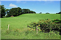
6
An open field, Gargadis
Pictured along Gargadis Road
Image: © Kenneth Allen
Taken: 8 Aug 2020
0.08 miles
7
Gargadis Road, Lisnahanna
Heading north-east
Image: © Kenneth Allen
Taken: 8 Aug 2020
0.09 miles
8
Scallen Road
Heading ESE at Lisnahanna
Image: © Kenneth Allen
Taken: 21 Apr 2015
0.09 miles
9
Scallen Road, Lisnahanna
Heading ESE from Lougherush Road
Image: © Kenneth Allen
Taken: 8 Aug 2020
0.09 miles
10
Scallen Road, Lisnahanna
Heading WNW
Image: © Kenneth Allen
Taken: 21 Apr 2015
0.11 miles