IMAGES TAKEN NEAR TO
Aghnamoe Road, OMAGH, BT78 3PQ
Introduction
This page details the photographs taken nearby to Aghnamoe Road, BT78 3PQ by members of the Geograph project.
The Geograph project started in 2005 with the aim of publishing, organising and preserving representative images for every square kilometre of Great Britain, Ireland and the Isle of Man.

There are currently over 7.5m images from over14,400 individuals and you can help contribute to the project by visiting https://www.geograph.org.uk
Image Map
Images are licensed for reuse under creativecommons.org/licenses/by-sa/2.0
Notes
- Clicking on the map will re-center to the selected point.
- The higher the marker number, the further away the image location is from the centre of the postcode.
Image Listing (18 Images Found)
Images are licensed for reuse under creativecommons.org/licenses/by-sa/2.0
Image
Details
Distance
1
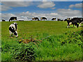
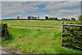
Herd of cattle, Aghnamoe
Pictured along Aghnamoe Road
Image: © Kenneth Allen
Taken: 28 May 2022
0.05 miles
2
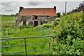
Ruined farmhouse, Aghnamoe (front view)
Pictured along Aghnamoe Road
Image: © Kenneth Allen
Taken: 28 May 2022
0.05 miles
3
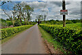
Aghnamoe Road
Heading ESE at Aghnamoe
Image: © Kenneth Allen
Taken: 28 May 2022
0.10 miles
4
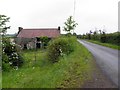
Aghnamoe Road
Heading WNW towards Aghnamoe
Image: © Kenneth Allen
Taken: 21 Jun 2011
0.10 miles
5
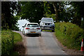
Passing cars, Aghnamoe
It's wise to draw in to let another vehicle pass on some of these country roads
Image: © Kenneth Allen
Taken: 28 May 2022
0.12 miles
6
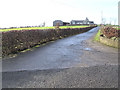
Farm at Aghnamoe
This farm has a concrete laneway connecting with the main road
Image: © Kenneth Allen
Taken: 14 Feb 2006
0.14 miles
7
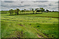
Cut grass, Aghnamoe
Looking SSW from Aghnamoe Road
Image: © Kenneth Allen
Taken: 28 May 2022
0.15 miles
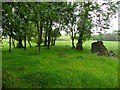
9
An open field, Aghnamoe
Pictured along Aghnamoe Road
Image: © Kenneth Allen
Taken: 28 May 2022
0.16 miles
10
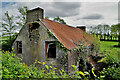
Ruined farmhouse, Aghnamoe (gable view)
Pictured along Aghnamoe Road
Image: © Kenneth Allen
Taken: 28 May 2022
0.18 miles