IMAGES TAKEN NEAR TO
Tonnagh Road, OMAGH, BT78 2LQ
Introduction
This page details the photographs taken nearby to Tonnagh Road, BT78 2LQ by members of the Geograph project.
The Geograph project started in 2005 with the aim of publishing, organising and preserving representative images for every square kilometre of Great Britain, Ireland and the Isle of Man.

There are currently over 7.5m images from over14,400 individuals and you can help contribute to the project by visiting https://www.geograph.org.uk
Image Map
Images are licensed for reuse under creativecommons.org/licenses/by-sa/2.0
Notes
- Clicking on the map will re-center to the selected point.
- The higher the marker number, the further away the image location is from the centre of the postcode.
Image Listing (19 Images Found)
Images are licensed for reuse under creativecommons.org/licenses/by-sa/2.0
Image
Details
Distance
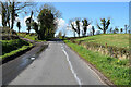
1
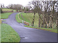
Vinegar Hill
The road at the top end is roughish after the tarred surface ends.
Image: © Kenneth Allen
Taken: 16 Feb 2006
0.02 miles
3
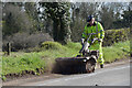
Clearing mud along Tonnagh Road
Pictured here Image]
Image: © Kenneth Allen
Taken: 14 Apr 2021
0.10 miles
4
Muddy bend along Tonnagh Road
Heading north-east at Rahony
The mud will be soon removed Image]
Image: © Kenneth Allen
Taken: 14 Apr 2021
0.10 miles
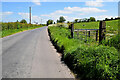
5
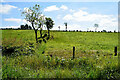
Rahony Townland
Looking south from Tonnagh Road
Image: © Kenneth Allen
Taken: 4 Jun 2022
0.11 miles
6
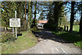
Lane to farm, Rahony
Pictured along Tonnagh Road
Image: © Kenneth Allen
Taken: 14 Apr 2021
0.11 miles
7
Rahony Townland
Pictured along Tonnagh Road
Image: © Kenneth Allen
Taken: 4 Jun 2022
0.12 miles
8
Minor road, Rahony
Pictured along Tonnagh Road
Image: © Kenneth Allen
Taken: 14 Apr 2021
0.14 miles
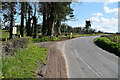
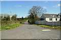
9
Tonnagh Road, Rahony
Heading south-west
Image: © Kenneth Allen
Taken: 14 Apr 2021
0.15 miles
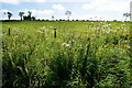
10
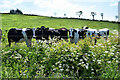
Cattle, Rahony
Pictured along Tonnagh Road
Image: © Kenneth Allen
Taken: 4 Jun 2022
0.15 miles