IMAGES TAKEN NEAR TO
Carnalea Road, OMAGH, BT78 2JG
Introduction
This page details the photographs taken nearby to Carnalea Road, BT78 2JG by members of the Geograph project.
The Geograph project started in 2005 with the aim of publishing, organising and preserving representative images for every square kilometre of Great Britain, Ireland and the Isle of Man.

There are currently over 7.5m images from over14,400 individuals and you can help contribute to the project by visiting https://www.geograph.org.uk
Image Map
Images are licensed for reuse under creativecommons.org/licenses/by-sa/2.0
Notes
- Clicking on the map will re-center to the selected point.
- The higher the marker number, the further away the image location is from the centre of the postcode.
Image Listing (19 Images Found)
Images are licensed for reuse under creativecommons.org/licenses/by-sa/2.0
Image
Details
Distance
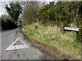
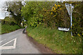
1
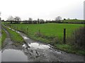
Muddy lane,Carnalea
Pictured along Carnalea Road
Image: © Kenneth Allen
Taken: 12 Dec 2011
0.07 miles
3
Kilcootry Townland
Looking south from Kilcootry Road
Image: © Kenneth Allen
Taken: 17 May 2021
0.09 miles
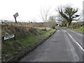
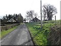
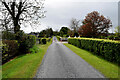
4
Carnalea Road, Kilcootry
Heading WSW from the junction with Kilcootry Road
Image: © Kenneth Allen
Taken: 17 May 2021
0.09 miles
5
Kilcootry Road
Heading WNW from Carnalea Road
Image: © Kenneth Allen
Taken: 14 Mar 2013
0.11 miles
6
Kilcootry Road, Kilcootry
Heading ESE towards Carnlaea Road
Image: © Kenneth Allen
Taken: 14 Mar 2013
0.11 miles
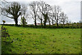
7
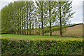
Line of trees, Kilcootry
Pictured along Kilcootry Road
Image: © Kenneth Allen
Taken: 17 May 2021
0.11 miles
8
Kilcootry Road
Heading south-east at Kilcootry
Image: © Kenneth Allen
Taken: 17 May 2021
0.11 miles
9
Kilcootry Road, Kilcootry
Heading north-west from Carnalea Road
Image: © Kenneth Allen
Taken: 17 May 2021
0.12 miles
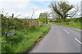
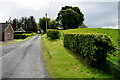
10
Neatly kept verges along Kilcootry Road
Heading south-east at Kilcootry
Image: © Kenneth Allen
Taken: 17 May 2021
0.12 miles