IMAGES TAKEN NEAR TO
Kilnahusogue Road, OMAGH, BT78 2EY
Introduction
This page details the photographs taken nearby to Kilnahusogue Road, BT78 2EY by members of the Geograph project.
The Geograph project started in 2005 with the aim of publishing, organising and preserving representative images for every square kilometre of Great Britain, Ireland and the Isle of Man.

There are currently over 7.5m images from over14,400 individuals and you can help contribute to the project by visiting https://www.geograph.org.uk
Image Map
Images are licensed for reuse under creativecommons.org/licenses/by-sa/2.0
Notes
- Clicking on the map will re-center to the selected point.
- The higher the marker number, the further away the image location is from the centre of the postcode.
Image Listing (34 Images Found)
Images are licensed for reuse under creativecommons.org/licenses/by-sa/2.0
Image
Details
Distance
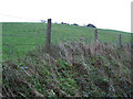
1
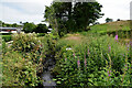
Hidden burn, Aghafad
Pictured along Kilnahusogue Road
Image: © Kenneth Allen
Taken: 15 Jul 2021
0.07 miles
2
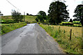
Kilnahusogue Road, Aghafad
Heading ESE
Image: © Kenneth Allen
Taken: 15 Jul 2021
0.08 miles
3
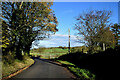
Bend along Kilnahusogue Road
Heading north at Aghafad
Image: © Kenneth Allen
Taken: 22 Oct 2020
0.09 miles
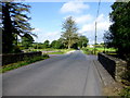
4
Bridge along Kilnahusogue Road
Heading over a small burn at Aghafad
In the background is a rath strategically placed on the top of a hill
Image: © Kenneth Allen
Taken: 22 Oct 2020
0.09 miles
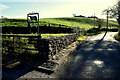
5
Bridge along Kilnahusogue Road
Pictured at Aghafad
Image: © Kenneth Allen
Taken: 30 Aug 2016
0.09 miles
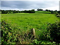
6
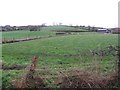
Aghafad Townland
Looking north-east from Kilnahusogue Road
Image: © Kenneth Allen
Taken: 22 Dec 2011
0.10 miles
7
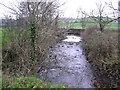
Stream at Lackagh
This waterway makes its way towards Fintona.
Image: © Kenneth Allen
Taken: 6 Jan 2006
0.10 miles
8
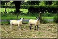
Sheep, Aghafad
Pictured along Kilnahusogue Road
Image: © Kenneth Allen
Taken: 15 Jul 2021
0.10 miles
9
Aghafad Townland
Looking north-east from Kilnahusogue Road
Image: © Kenneth Allen
Taken: 30 Aug 2016
0.10 miles
10
Hill fort at Forthill, Lackagh
This was indicated as a rath on the map, but the locals say that it is a hill fort. It dominates the surrounding countryside.
Image: © Kenneth Allen
Taken: 6 Jan 2006
0.11 miles