IMAGES TAKEN NEAR TO
Annaghbo Road, OMAGH, BT78 2EB
Introduction
This page details the photographs taken nearby to Annaghbo Road, BT78 2EB by members of the Geograph project.
The Geograph project started in 2005 with the aim of publishing, organising and preserving representative images for every square kilometre of Great Britain, Ireland and the Isle of Man.

There are currently over 7.5m images from over14,400 individuals and you can help contribute to the project by visiting https://www.geograph.org.uk
Image Map
Images are licensed for reuse under creativecommons.org/licenses/by-sa/2.0
Notes
- Clicking on the map will re-center to the selected point.
- The higher the marker number, the further away the image location is from the centre of the postcode.
Image Listing (11 Images Found)
Images are licensed for reuse under creativecommons.org/licenses/by-sa/2.0
Image
Details
Distance
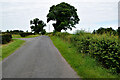
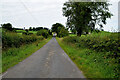
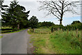
1
Annaghbo Road, Feenan / Annaghmumin
Heading west
Image: © Kenneth Allen
Taken: 28 Jul 2022
0.03 miles
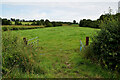
2
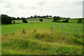
An open field, Feenan
Looking south from Annaghbo Road
Image: © Kenneth Allen
Taken: 28 Jul 2022
0.05 miles
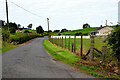
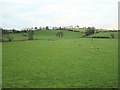
3
Annaghmumin Townland
Pictured along Annaghbo Road
Image: © Kenneth Allen
Taken: 28 Jul 2022
0.08 miles
4
Annaghbo Road
Heading west from Annaghbo to Feenan / Annaghmumin
Image: © Kenneth Allen
Taken: 28 Jul 2022
0.09 miles
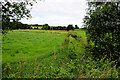
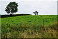
5
An open field, Annaghbo
Pictured along Annaghbo Road
Image: © Kenneth Allen
Taken: 28 Jul 2022
0.09 miles
6
Annaghmurnin Townland
Green pasture lands outside Fintona
Image: © Kenneth Allen
Taken: 17 Dec 2005
0.12 miles
7
Trees on a hill, Annaghmumin
Looking NNW from Annaghbo Road
Image: © Kenneth Allen
Taken: 28 Jul 2022
0.13 miles
8

Feenan Townland
Pictured along Annaghbo road
Image: © Kenneth Allen
Taken: 28 Jul 2022
0.16 miles
9
Annaghbo Road, Feenan / Annaghmumin
Heading WNW
Image: © Kenneth Allen
Taken: 28 Jul 2022
0.16 miles