IMAGES TAKEN NEAR TO
Dunnamona Road, OMAGH, BT78 2EA
Introduction
This page details the photographs taken nearby to Dunnamona Road, BT78 2EA by members of the Geograph project.
The Geograph project started in 2005 with the aim of publishing, organising and preserving representative images for every square kilometre of Great Britain, Ireland and the Isle of Man.

There are currently over 7.5m images from over14,400 individuals and you can help contribute to the project by visiting https://www.geograph.org.uk
Image Map
Images are licensed for reuse under creativecommons.org/licenses/by-sa/2.0
Notes
- Clicking on the map will re-center to the selected point.
- The higher the marker number, the further away the image location is from the centre of the postcode.
Image Listing (28 Images Found)
Images are licensed for reuse under creativecommons.org/licenses/by-sa/2.0
Image
Details
Distance
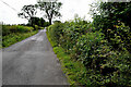
1
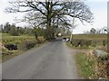
Dunnamona Road, Cranny
Heading north-west
Image: © Kenneth Allen
Taken: 6 Apr 2013
0.05 miles
2
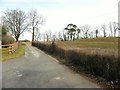
Lane, Cranny
Pictured along Dunnamona Road
Image: © Kenneth Allen
Taken: 6 Apr 2013
0.05 miles
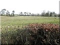
3
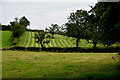
Cranny Townland
Looking north-east from Dunnamona Road
Image: © Kenneth Allen
Taken: 28 Jul 2022
0.06 miles
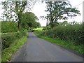
4
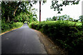
Dunnamona Road, Cranny
Heading north-west
Image: © Kenneth Allen
Taken: 28 Jul 2022
0.07 miles
5
A low hedge, Cranny
Pictured along Dunnamona Road
Image: © Kenneth Allen
Taken: 6 Apr 2013
0.09 miles
6
Corrugated iron stops a gap, Cranny
Pictured along Dunnamona Road
Image: © Kenneth Allen
Taken: 6 Apr 2013
0.11 miles
7
Hidden bridge along Dunnamona Road
Heading SSE from Cranny to Cumber
Image: © Kenneth Allen
Taken: 28 Jul 2022
0.11 miles
8
Dunnamona Road, Annaghmurrin
Heading NNW
Image: © Kenneth Allen
Taken: 21 Aug 2009
0.15 miles
9
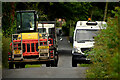
Passing vehicles along Dunnamore Road
Fortunately there was a drawn-in spot along the road
Image: © Kenneth Allen
Taken: 28 Jul 2022
0.15 miles
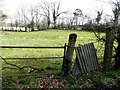
10
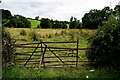
Damaged gate, Cranny
Pictured along Dunnamona Road
Image: © Kenneth Allen
Taken: 28 Jul 2022
0.17 miles