IMAGES TAKEN NEAR TO
Dunnamona Road, OMAGH, BT78 2DY
Introduction
This page details the photographs taken nearby to Dunnamona Road, BT78 2DY by members of the Geograph project.
The Geograph project started in 2005 with the aim of publishing, organising and preserving representative images for every square kilometre of Great Britain, Ireland and the Isle of Man.

There are currently over 7.5m images from over14,400 individuals and you can help contribute to the project by visiting https://www.geograph.org.uk
Image Map
Images are licensed for reuse under creativecommons.org/licenses/by-sa/2.0
Notes
- Clicking on the map will re-center to the selected point.
- The higher the marker number, the further away the image location is from the centre of the postcode.
Image Listing (6 Images Found)
Images are licensed for reuse under creativecommons.org/licenses/by-sa/2.0
Image
Details
Distance
1
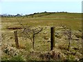
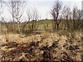
Posts, Cranny
Looking north-east from Dunnamona Road
Image: © Kenneth Allen
Taken: 6 Apr 2013
0.06 miles
2
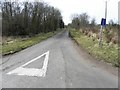
Dead-end road, Cranny
Heading WSW from Dunnamona Road
Image: © Kenneth Allen
Taken: 6 Apr 2013
0.08 miles
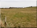
5
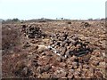
"Winning the turf", Cranny
A traditional method of cutting turf for burning in the open fire and it involved digging by hand and stacking the clods up to dry out before taking back to the turf shed beside the dwelling house. These look to be rounded so I'm not sure if the traditional turf spade was used. This method of recovering turf in bygone years didn't have too much impact on the environment as it gave the bogs time to re-generate.
This image reminds me of a bygone era https://plus.google.com/photos/101203544004597142257/albums/5451869157631021681/5452254142409813410?banner=pwa
Image: © Kenneth Allen
Taken: 6 Apr 2013
0.13 miles