IMAGES TAKEN NEAR TO
Legatiggle Road, OMAGH, BT78 2DN
Introduction
This page details the photographs taken nearby to Legatiggle Road, BT78 2DN by members of the Geograph project.
The Geograph project started in 2005 with the aim of publishing, organising and preserving representative images for every square kilometre of Great Britain, Ireland and the Isle of Man.

There are currently over 7.5m images from over14,400 individuals and you can help contribute to the project by visiting https://www.geograph.org.uk
Image Map
Images are licensed for reuse under creativecommons.org/licenses/by-sa/2.0
Notes
- Clicking on the map will re-center to the selected point.
- The higher the marker number, the further away the image location is from the centre of the postcode.
Image Listing (14 Images Found)
Images are licensed for reuse under creativecommons.org/licenses/by-sa/2.0
Image
Details
Distance
1
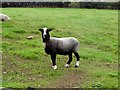
A colourful sheep, Legatiggle
Pictured along Legatiggle road
Image: © Kenneth Allen
Taken: 27 Aug 2013
0.03 miles
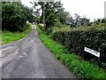
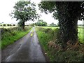
2
Legatiggle Road, Legatiggle
Heading SSE
Image: © Kenneth Allen
Taken: 27 Aug 2013
0.03 miles
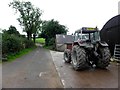
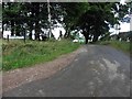
3
Legatiggle Road
Heading north from Blackhill Road
Image: © Kenneth Allen
Taken: 27 Aug 2013
0.07 miles
4
Blackhill Road, Legatiggle
Heading ESE from the junction with Legatiggle Road
Image: © Kenneth Allen
Taken: 27 Aug 2013
0.11 miles
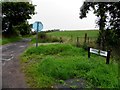
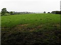
5
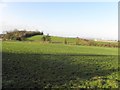
Killyliss Townland
Looking north-west from Killyliss Road
Image: © Kenneth Allen
Taken: 7 Dec 2011
0.14 miles
6
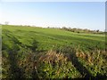
Legatiggle Townland
Looking north-east from Blackhill Road
Image: © Kenneth Allen
Taken: 7 Dec 2011
0.17 miles
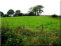
7
Blackhill Road
Heading WNW from Killyliss Road
Image: © Kenneth Allen
Taken: 27 Aug 2013
0.17 miles
8
Blackhill Road, Killyliss
Heading ESE
Image: © Kenneth Allen
Taken: 27 Aug 2013
0.18 miles
9
Misty at Killyliss
Pictured along Blackhill Road - I could see the approaching rain
Image: © Kenneth Allen
Taken: 27 Aug 2013
0.18 miles
10
A low hill, Legatiggle
Pictured along Legatiggle Road
Image: © Kenneth Allen
Taken: 27 Aug 2013
0.19 miles