IMAGES TAKEN NEAR TO
Letfern Road, OMAGH, BT78 1UL
Introduction
This page details the photographs taken nearby to Letfern Road, BT78 1UL by members of the Geograph project.
The Geograph project started in 2005 with the aim of publishing, organising and preserving representative images for every square kilometre of Great Britain, Ireland and the Isle of Man.

There are currently over 7.5m images from over14,400 individuals and you can help contribute to the project by visiting https://www.geograph.org.uk
Image Map
Images are licensed for reuse under creativecommons.org/licenses/by-sa/2.0
Notes
- Clicking on the map will re-center to the selected point.
- The higher the marker number, the further away the image location is from the centre of the postcode.
Image Listing (120 Images Found)
Images are licensed for reuse under creativecommons.org/licenses/by-sa/2.0
Image
Details
Distance
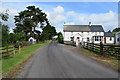
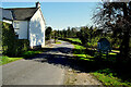
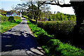
2
Letfern Road
Heading ESE towards Beagh
Image: © Kenneth Allen
Taken: 26 Jan 2012
0.01 miles
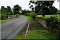
4
Bridge along Letfern Road
Looking ESE at Letfern
Image: © Kenneth Allen
Taken: 24 Nov 2016
0.02 miles
5
Shadows on a wall, Letfern
Pictured along Letfern Road
Image: © Kenneth Allen
Taken: 21 Apr 2023
0.02 miles
6
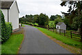
Tiny building along Letfern Road
Pictured at Letfern
Image: © Kenneth Allen
Taken: 20 Sep 2021
0.03 miles
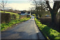
7
Bridge along Letfern Road
Heading ESE at Letfern
Image: © Kenneth Allen
Taken: 20 Sep 2021
0.03 miles
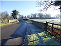
8
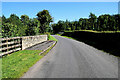
Bridge along Letfern Road
Heading east at Letfern
Image: © Kenneth Allen
Taken: 4 Sep 2023
0.03 miles
9
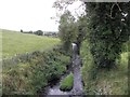
Burn, Letfern
Pictured from Letfern Road - it heads south-west to join the Eskragh Water
Image: © Kenneth Allen
Taken: 1 Oct 2012
0.04 miles
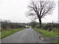
10
Tree shadow along Letfern Road
Heading south-east at Letfern
Image: © Kenneth Allen
Taken: 21 Apr 2023
0.04 miles