IMAGES TAKEN NEAR TO
Drumragh Road, OMAGH, BT78 1UB
Introduction
This page details the photographs taken nearby to Drumragh Road, BT78 1UB by members of the Geograph project.
The Geograph project started in 2005 with the aim of publishing, organising and preserving representative images for every square kilometre of Great Britain, Ireland and the Isle of Man.

There are currently over 7.5m images from over14,400 individuals and you can help contribute to the project by visiting https://www.geograph.org.uk
Image Map
Images are licensed for reuse under creativecommons.org/licenses/by-sa/2.0
Notes
- Clicking on the map will re-center to the selected point.
- The higher the marker number, the further away the image location is from the centre of the postcode.
Image Listing (44 Images Found)
Images are licensed for reuse under creativecommons.org/licenses/by-sa/2.0
Image
Details
Distance
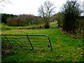
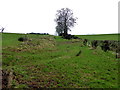
1
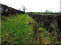
A grassy lane, Freughmore
Heading ESE
Image: © Kenneth Allen
Taken: 24 Feb 2017
0.03 miles
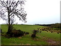
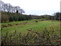
2
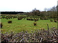
Rushy ground, Freughmore
Looking south
Image: © Kenneth Allen
Taken: 24 Feb 2017
0.03 miles
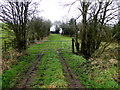
6
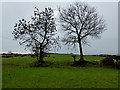
Trees, Freughmore
A brief appearance of the sun
Image: © Kenneth Allen
Taken: 24 Feb 2017
0.09 miles
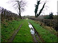
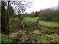
10
Drumconnelly Townland
Image: © Kenneth Allen
Taken: 24 Feb 2017
0.12 miles