IMAGES TAKEN NEAR TO
Glenhoy Road, AUGHER, BT77 0DF
Introduction
This page details the photographs taken nearby to Glenhoy Road, BT77 0DF by members of the Geograph project.
The Geograph project started in 2005 with the aim of publishing, organising and preserving representative images for every square kilometre of Great Britain, Ireland and the Isle of Man.

There are currently over 7.5m images from over14,400 individuals and you can help contribute to the project by visiting https://www.geograph.org.uk
Image Map
Images are licensed for reuse under creativecommons.org/licenses/by-sa/2.0
Notes
- Clicking on the map will re-center to the selected point.
- The higher the marker number, the further away the image location is from the centre of the postcode.
Image Listing (19 Images Found)
Images are licensed for reuse under creativecommons.org/licenses/by-sa/2.0
Image
Details
Distance
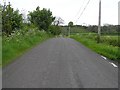
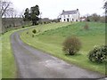
1
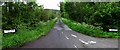
Glenhoy Road
It divides two townlands, Knockmany on the left and Annagarvey to the right
Image: © Kenneth Allen
Taken: 19 May 2009
0.02 miles
2
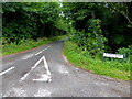
Glenhoy Road, Knockmany / Annagarvey
Heading north-west
Image: © Kenneth Allen
Taken: 5 Jul 2017
0.06 miles
4
Glenhoy Road, Annagarvey
Looking east
Image: © Kenneth Allen
Taken: 19 May 2009
0.08 miles
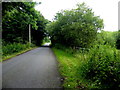
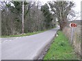
6
Glenhoy Road
Heading east at Annagarvey
Image: © Kenneth Allen
Taken: 5 Jul 2017
0.09 miles
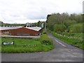
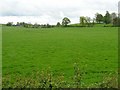
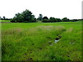
7
Annagarvey Townland, Augher
The view looking north
Image: © Kenneth Allen
Taken: 10 Apr 2006
0.09 miles
8
Annagarvey Road
Looking south-east from the Glenhoy Road
Image: © Kenneth Allen
Taken: 19 May 2009
0.11 miles
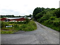
9
House at Divinagh
It is in an elevated position and the daffodils are about to come out
Image: © Kenneth Allen
Taken: 10 Apr 2006
0.14 miles
10
Knockmany Townland
Looking WSW from Glenhoy Road
Image: © Kenneth Allen
Taken: 5 Jul 2017
0.16 miles