IMAGES TAKEN NEAR TO
Aghintain Road, FIVEMILETOWN, BT75 0LH
Introduction
This page details the photographs taken nearby to Aghintain Road, BT75 0LH by members of the Geograph project.
The Geograph project started in 2005 with the aim of publishing, organising and preserving representative images for every square kilometre of Great Britain, Ireland and the Isle of Man.

There are currently over 7.5m images from over14,400 individuals and you can help contribute to the project by visiting https://www.geograph.org.uk
Image Map
Images are licensed for reuse under creativecommons.org/licenses/by-sa/2.0
Notes
- Clicking on the map will re-center to the selected point.
- The higher the marker number, the further away the image location is from the centre of the postcode.
Image Listing (36 Images Found)
Images are licensed for reuse under creativecommons.org/licenses/by-sa/2.0
Image
Details
Distance
1
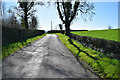
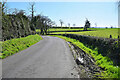
Tree shadows, Losset
Pictured along Aghintain Road
Image: © Kenneth Allen
Taken: 2 Apr 2021
0.03 miles
2
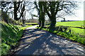
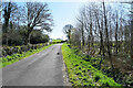
Shadows along Aghintain Road
Heading ESE at Losset
Image: © Kenneth Allen
Taken: 2 Apr 2021
0.04 miles
3
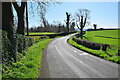
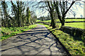
Bend along Aghintain Road
Heading ESE at Losset
Image: © Kenneth Allen
Taken: 2 Apr 2021
0.04 miles
4
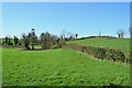
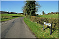
Losset / Aghingowly
Pictured along Aghintain Road
Image: © Kenneth Allen
Taken: 2 Apr 2021
0.07 miles
5
Muddy along Aghintain Road
Heading east at Losset
Image: © Kenneth Allen
Taken: 2 Apr 2021
0.11 miles
6
Aghintain Road, Losset / Aghingowly
Heading ESE
Image: © Kenneth Allen
Taken: 2 Apr 2021
0.12 miles
7
Shadows, Aghintain Road
Heading east at Losset
Image: © Kenneth Allen
Taken: 2 Apr 2021
0.12 miles
9
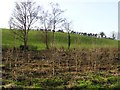
Aghingowly Townland
Newly planted trees here.
Image: © Kenneth Allen
Taken: 2 Jan 2007
0.14 miles
10
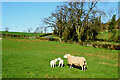
Ewe and lambs, Losset
Pictured along Aghantain Road
Image: © Kenneth Allen
Taken: 2 Apr 2021
0.15 miles