IMAGES TAKEN NEAR TO
The Brook, ENNISKILLEN, BT74 7EU
Introduction
This page details the photographs taken nearby to The Brook, BT74 7EU by members of the Geograph project.
The Geograph project started in 2005 with the aim of publishing, organising and preserving representative images for every square kilometre of Great Britain, Ireland and the Isle of Man.

There are currently over 7.5m images from over14,400 individuals and you can help contribute to the project by visiting https://www.geograph.org.uk
Image Map
Images are licensed for reuse under creativecommons.org/licenses/by-sa/2.0
Notes
- Clicking on the map will re-center to the selected point.
- The higher the marker number, the further away the image location is from the centre of the postcode.
Image Listing (455 Images Found)
Images are licensed for reuse under creativecommons.org/licenses/by-sa/2.0
Image
Details
Distance
1
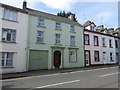
Period house, Enniskillen
Pictured along The Brook
Image: © Kenneth Allen
Taken: 16 May 2014
0.02 miles
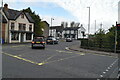
2
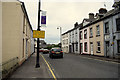
The Brook, Enniskillen
Heading ESE towards Anne Street
Image: © Kenneth Allen
Taken: 9 Aug 2020
0.03 miles
3
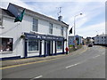
The Lough Inn, Enniskillen
It is located at The Brook
Image: © Kenneth Allen
Taken: 16 May 2014
0.04 miles
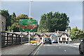
6
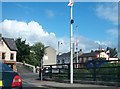
Portora Wharf, Enniskillen
Looking NNE - further along is the Round "O" Quay
Image: © Kenneth Allen
Taken: 26 Jul 2012
0.05 miles
8
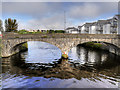
Enniskillen, Erne Bridge
The River Erne is the second-longest river in Ulster. It rises on the east shoulder of Slieve Glah mountain and flows 80 miles through Lough Gowna, Lough Oughter and Upper and Lower Lough Erne, County Fermanagh, to the sea at Ballyshannon.
The town of Enniskillen is mostly situated on an island in the river, between Upper and Lower Lough Erne. Before 1950, the only access to the town was by two bridges, the present East Bridge (built in 1892) and the West Bridge, or Erne Bridge, which was built in 1885.
Image: © David Dixon
Taken: 25 Sep 2017
0.05 miles
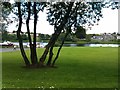
9
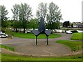
Band stand, Brook Park, Enniskillen
Pictured beside the Round O Quay
Image: © Kenneth Allen
Taken: 7 May 2018
0.05 miles
10
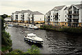
Erne River, Windmill Hill / Enniskillen
Looking north from Erne Bridge
Image: © Kenneth Allen
Taken: 9 Aug 2020
0.06 miles