IMAGES TAKEN NEAR TO
High Street, ENNISKILLEN, BT74 7DH
Introduction
This page details the photographs taken nearby to High Street, BT74 7DH by members of the Geograph project.
The Geograph project started in 2005 with the aim of publishing, organising and preserving representative images for every square kilometre of Great Britain, Ireland and the Isle of Man.

There are currently over 7.5m images from over14,400 individuals and you can help contribute to the project by visiting https://www.geograph.org.uk
Image Map
Images are licensed for reuse under creativecommons.org/licenses/by-sa/2.0
Notes
- Clicking on the map will re-center to the selected point.
- The higher the marker number, the further away the image location is from the centre of the postcode.
Image Listing (544 Images Found)
Images are licensed for reuse under creativecommons.org/licenses/by-sa/2.0
Image
Details
Distance
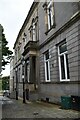
1
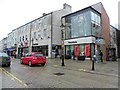
Houstons, Enniskillen
Looking north from The Diamond
Image: © Kenneth Allen
Taken: 10 Feb 2012
0.01 miles
2
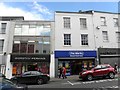
Dorothy Perkins / The Works, Enniskillen
They are located along High Street
Image: © Kenneth Allen
Taken: 30 May 2011
0.01 miles
3
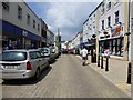
Townhall Street, Enniskillen
Heading north-west
Image: © Kenneth Allen
Taken: 6 Jun 2013
0.01 miles
4
Townhall Street, Enniskillen
Looking NNW - this area of the town is known as The Diamond
Image: © Kenneth Allen
Taken: 16 May 2014
0.01 miles
5
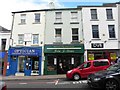
Optician / John J Sloan / DV8
They are located at High Street, Enniskillen
Image: © Kenneth Allen
Taken: 30 May 2011
0.01 miles
6
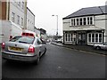
Cross Street, Enniskillen
Looking north-west
Image: © Kenneth Allen
Taken: 10 Feb 2012
0.02 miles
7
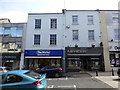
The Works / Mercer, Enniskillen
They are located at High Street
Image: © Kenneth Allen
Taken: 16 May 2014
0.02 miles
8
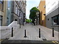
Pedestrian way, Enniskillen
An extension of Water Street
Image: © Kenneth Allen
Taken: 16 May 2014
0.02 miles
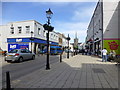
10
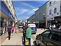
High Street, Enniskillen
Heading NNW
Image: © Kenneth Allen
Taken: 18 Jun 2021
0.02 miles