IMAGES TAKEN NEAR TO
Nugents Entry, ENNISKILLEN, BT74 7DF
Introduction
This page details the photographs taken nearby to Nugents Entry, BT74 7DF by members of the Geograph project.
The Geograph project started in 2005 with the aim of publishing, organising and preserving representative images for every square kilometre of Great Britain, Ireland and the Isle of Man.

There are currently over 7.5m images from over14,400 individuals and you can help contribute to the project by visiting https://www.geograph.org.uk
Image Map
Images are licensed for reuse under creativecommons.org/licenses/by-sa/2.0
Notes
- Clicking on the map will re-center to the selected point.
- The higher the marker number, the further away the image location is from the centre of the postcode.
Image Listing (492 Images Found)
Images are licensed for reuse under creativecommons.org/licenses/by-sa/2.0
Image
Details
Distance
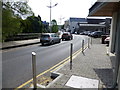
1
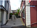
Nugents Entry
Heading SSW from Queen Elizabeth Road
Image: © Kenneth Allen
Taken: 16 May 2014
0.01 miles
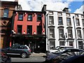
3
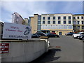
Imperial Buildings, Enniskillen
Looking south-west from Queen Elizabeth Road
Image: © Kenneth Allen
Taken: 16 May 2014
0.02 miles
4
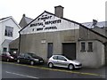
Impartial Reporter Building, Enniskillen
Viewed from Queen Elizabeth Road; a close-up of the tablet is shown here Image]
Image: © Kenneth Allen
Taken: 14 May 2009
0.02 miles
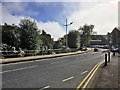
5
Queen Elizabeth Road, Enniskillen
Heading south-east
Image: © Kenneth Allen
Taken: 16 May 2014
0.02 miles
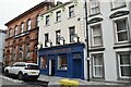
6
Bush Bar, Enniskillen
It is located along Townhall Street
Image: © Kenneth Allen
Taken: 28 May 2010
0.03 miles
8
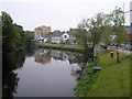
The Erne at Nugents Quay, Enniskillen
Looking SSE
Image: © Kenneth Allen
Taken: 14 May 2009
0.03 miles
9
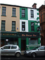
The Corner Bar, Enniskillen
It is located at Townhall Street
Image: © Kenneth Allen
Taken: 18 Aug 2008
0.03 miles
10
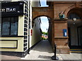
Nugents Entry, Enniskillen
Pictured here Image]
Image: © Kenneth Allen
Taken: 16 May 2014
0.03 miles