IMAGES TAKEN NEAR TO
Cromwell Road, BELFAST, BT7 1NE

Introduction

This page details the photographs taken nearby to Cromwell Road, BT7 1NE by members of the Geograph project.

The Geograph project started in 2005 with the aim of publishing, organising and preserving representative images for every square kilometre of Great Britain, Ireland and the Isle of Man.

There are currently over 7.5m images from over14,400 individuals and you can help contribute to the project by visiting https://www.geograph.org.uk

Image Map


Images are licensed for reuse under creativecommons.org/licenses/by-sa/2.0
Notes
  • Clicking on the map will re-center to the selected point.
  • The higher the marker number, the further away the image location is from the centre of the postcode.

Image Listing (549 Images Found)

Images are licensed for reuse under creativecommons.org/licenses/by-sa/2.0
  • ...
Image
Details
Distance
1
Mayne Foundry drain cover, Belfast (1)
A drain cover, on the Cromwell Road, almost opposite Canterbury Street, made by the Mayne Foundry, Belfast. The business traded as Mayne & Co, engineers and founders, from 25/37 McTier Street (off the Shankill Road) in the early part of the 20th century. Image shows the maker’s name.
Image: © Albert Bridge Taken: 27 May 2012
0.02 miles
2
Mayne Foundry drain cover, Belfast (2)
See Image The inscription showing the maker’s name. The address is only partly legible.
Image: © Albert Bridge Taken: 27 May 2012
0.02 miles
3
Eblana Street, Belfast
Part of bed-sit land, Eblana Street runs from University Street to the Cromwell Road (background).
Image: © Albert Bridge Taken: 19 Apr 2009
0.03 miles
4
Apartments, Cromwell Road, Belfast (May 2018)
Social housing apartments, on the Cromwell Road, seen from Cameron Street. Also visible (background) in Image
Image: © Albert Bridge Taken: 6 May 2018
0.03 miles
5
McClure Street, Belfast
See Image The same street, at the Ormeau Road end, showing the free all-day parking (used by non-residents).
Image: © Albert Bridge Taken: 12 Feb 2010
0.03 miles
6
Westminster Street, Belfast
Part of bed-sit land running from University Street to the Cromwell Road (background).
Image: © Albert Bridge Taken: 19 Apr 2009
0.04 miles
7
Street parking, Belfast
Much to the consternation of many residents, inner-city streets in Belfast are used by commuters for all-day parking. There is a proposal to introduce residents-only parking legislation. This is McClure Street close to Botanic Avenue.
Image: © Albert Bridge Taken: 9 Jun 2009
0.05 miles
8
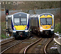
Two trains, Belfast
Two trains close to Botanic Railway Station in Belfast. On the left is Northern Ireland Railways C4K set 4020 which has just left the station on a service from Belfast Great Victoria Street to Larne Harbour; approaching on the right is C3K set 3003 on a service from Derry/Londonderry to Belfast Great Victoria Street. See this related picture from April 2009 Image taken from the same location.
Image: © Rossographer Taken: 25 Mar 2013
0.06 miles
9
The east side of All Saints Church in University Street
Image: © David Smith Taken: 18 Sep 2012
0.06 miles
10
Hotel car park and Belfast's skyline (early morning)
Seen from the third floor of the Holiday Inn Express hotel. Clouds obscure the tops of the hills to the north
Image: © David Smith Taken: 19 Sep 2012
0.06 miles
  • ...