IMAGES TAKEN NEAR TO
College Green Mews, BELFAST, BT7 1LW

Introduction

This page details the photographs taken nearby to College Green Mews, BT7 1LW by members of the Geograph project.

The Geograph project started in 2005 with the aim of publishing, organising and preserving representative images for every square kilometre of Great Britain, Ireland and the Isle of Man.

There are currently over 7.5m images from over14,400 individuals and you can help contribute to the project by visiting https://www.geograph.org.uk

Image Map


Images are licensed for reuse under creativecommons.org/licenses/by-sa/2.0
Notes
  • Clicking on the map will re-center to the selected point.
  • The higher the marker number, the further away the image location is from the centre of the postcode.

Image Listing (942 Images Found)

Images are licensed for reuse under creativecommons.org/licenses/by-sa/2.0
  • ...
Image
Details
Distance
1
Street sign, Belfast
See Image Another of the old tiled signs with an imperial-measurement fire point sign – at the western end of College Green.
Image: © Albert Bridge Taken: 21 Mar 2009
0.01 miles
2
College Green Mews, Belfast (December 2018)
See Image (February 2008). The view towards Botanic Avenue. Fitzroy Presbyterian church is on the right.
Image: © Albert Bridge Taken: 30 Dec 2018
0.01 miles
3
Colourful MINI, Belfast
A MINI Clubman, in Botanic Avenue, in a livery advertising a used-car website.
Image: © Albert Bridge Taken: 4 Aug 2009
0.02 miles
4
Unilink bus, Belfast (2)
See Image The same service at the same stop as a Metro 7B from Laurelgrove (via Forestside) to the City Centre service stops to pick up passengers. Continue to Image
Image: © Albert Bridge Taken: 16 Oct 2009
0.02 miles
5
Postbox, Botanic Avenue
Queen Elizabeth II postbox near the southern end of Botanic Avenue in Belfast.
Image: © Rossographer Taken: 26 Oct 2009
0.02 miles
6
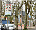
20 mph zone sign, Belfast Avenue, Belfast (April 2015)
The start of a 20 mph zone at Botanic Avenue/College Park.
Image: © Albert Bridge Taken: 5 Apr 2015
0.03 miles
7
View west along University Street
This image was taken from the corner of Rugby Road.
Image: © Eric Jones Taken: 17 Feb 2015
0.03 miles
8
Nos 101-111 Botanic Avenue, Belfast (1)
Nos 101-111 Botanic Avenue seen from opposite Duke’s Hotel. The building on the corner (right) is numbered as 63 University Street and does not seem to be proposed for demolition.
Image: © Albert Bridge Taken: 3 Feb 2013
0.03 miles
9
101-111 Botanic Avenue Belfast (2)
Nos 101-111 Botanic Avenue (College Park East on the Google map) seen from close to here Image The building on the corner (right) is numbered as 63 University Street and does not seem to be proposed for demolition. University Square Mews Image is on the left.
Image: © Albert Bridge Taken: 3 Feb 2013
0.03 miles
10
Nos 101-111 Botanic Avenue, Belfast (2013-1)
The front of nos 101-111 Botanic Avenue. The Planning Service website discloses that the application for planning permission is still under consideration.
Image: © Albert Bridge Taken: 7 Jul 2013
0.03 miles
  • ...