1
College Park Avenue, Belfast
College Park Avenue is a tree-lined street of Victorian terraced houses running off Rugby Road, to the NE of the Botanic Gardens. This is the view towards Rugby Avenue and the Ormeau Road.
Image: © Albert Bridge
Taken: 16 Jul 2007
0.01 miles
2
Spar, University Avenue, Belfast (October 2017)
A Spar shop at 27 University Street (corner of Carmel Street). I have no connection with the business.
Image: © Albert Bridge
Taken: 7 Oct 2017
0.03 miles
3
The junction of Carmel Street and Agincourt Avenue in the Queen's Quarter
The vast majority of these houses are multi-occupancy rooming houses for university students.
Image: © Eric Jones
Taken: 19 May 2012
0.03 miles
4
Telephone boxes, Carmel Street, Belfast (October 2017)
Two KX100 telephone boxes at the University Avenue end of Carmel Street. The background gives a clue to the overall grottiness and run-down feel to the general area between University Street and the Ormeau Road – a mixed locality of students, drop-outs, east European, Middle-Eastern and north African immigrants living in privately-rented houses (many of multiple occupation) and flats. There might even be a few native Belfastyins left but I doubt it.
Image: © Albert Bridge
Taken: 7 Oct 2017
0.04 miles
5
The City Church in Carmel Street, Belfast
Carmel Street is part of Belfast's so called "Holyland". It is an area of the Queen's Quarter in which the streets have Biblical names. City Church is a charismatic church established in the 1980s.
http://www.citychurchbelfast.org/who-we-are/our-history/
Image: © Eric Jones
Taken: 17 Feb 2015
0.05 miles
6
Rugby Street, Belfast
A short street, of substantial terrace houses, built around 1870. It runs off Rugby Road
Image The more recent Rugby Mews is in the background.
Image: © Albert Bridge
Taken: 4 Aug 2009
0.05 miles
7
Short entry, Belfast
See
Image A short entry – also off Carmel Street and not shown on the Google map.
Image: © Albert Bridge
Taken: 26 Aug 2009
0.05 miles
8
Clough Williams-Ellis plaque, Belfast
The plaque on the University Avenue side of the First Church of Christ, Scientist.
Image: © Albert Bridge
Taken: 23 Aug 2013
0.05 miles
9
First Church of Christ, Scientist, Belfast - June 2014(2)
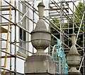
Ornamental gate pillars on the University Avenue side of the church.
Image: © Albert Bridge
Taken: 21 Jun 2014
0.05 miles
10
Iglesia ni Cristo (architect Clough Williams Ellis)
This impressive building now belongs to the Filipino sect the Iglesia ni Cristo and is designed by Welsh architect Clough Williams-Ellis. They moved into this building in 2013, and it formerly belonged to the Christian Scientists. Iglesia ni Cristo believes it is the only true church, so doesn't align itself with either Protestants or Roman Catholics, although I'm sure certain people in Belfast will have their own opinions.
Image: © Raymond Bell
Taken: 16 Jul 2017
0.05 miles


