IMAGES TAKEN NEAR TO
Creevelough Road, DUNGANNON, BT70 1LL
Introduction
This page details the photographs taken nearby to Creevelough Road, BT70 1LL by members of the Geograph project.
The Geograph project started in 2005 with the aim of publishing, organising and preserving representative images for every square kilometre of Great Britain, Ireland and the Isle of Man.

There are currently over 7.5m images from over14,400 individuals and you can help contribute to the project by visiting https://www.geograph.org.uk
Image Map
Images are licensed for reuse under creativecommons.org/licenses/by-sa/2.0
Notes
- Clicking on the map will re-center to the selected point.
- The higher the marker number, the further away the image location is from the centre of the postcode.
Image Listing (20 Images Found)
Images are licensed for reuse under creativecommons.org/licenses/by-sa/2.0
Image
Details
Distance
1
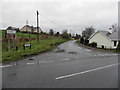
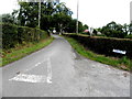
Creevelough Road
Heading north-east from Rehaghy Road
Image: © Kenneth Allen
Taken: 31 Dec 2014
0.06 miles
2
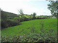
Church Plantation
Looking at the forested area to the left
Image: © Kenneth Allen
Taken: 19 Sep 2006
0.07 miles
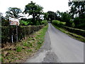
3
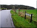
Rehaghy Road, Creevelough
Bending east
Image: © Kenneth Allen
Taken: 31 Dec 2014
0.09 miles
4
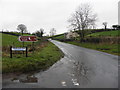
Rehaghy Road, Creevelough
Heading west from the junction with Creevelough Road
Image: © Kenneth Allen
Taken: 31 Dec 2014
0.10 miles
5
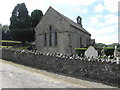
Holy Trinity Church, Brantry
See close-up of board here Image]
Image: © Kenneth Allen
Taken: 15 Aug 2016
0.11 miles
6
Creevelough Road, Creevelough
Heading north from the junction with Brantry Road
Image: © Kenneth Allen
Taken: 15 Aug 2016
0.11 miles
7
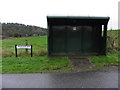
Bus shelter, Creevelough
Pictured at the junction of Creevelough Road and Rehaghy Road.
Image: © Kenneth Allen
Taken: 31 Dec 2014
0.11 miles
8
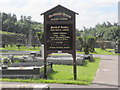
Church information board, Brantry COI
Pictured here Image]
Image: © Kenneth Allen
Taken: 15 Aug 2016
0.12 miles
9
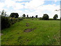
Creevelough Townland
Looking WSW form Creevelough Road
Image: © Kenneth Allen
Taken: 15 Aug 2016
0.14 miles
10
Brantry Road, Creevelough
Heading east from Creevelough Road
Image: © Kenneth Allen
Taken: 15 Aug 2016
0.15 miles