
IMAGES TAKEN NEAR TO
Ladas Drive, BELFAST, BT6 9FQ
Introduction
This page details the photographs taken nearby to Ladas Drive, BT6 9FQ by members of the Geograph project.
The Geograph project started in 2005 with the aim of publishing, organising and preserving representative images for every square kilometre of Great Britain, Ireland and the Isle of Man.

There are currently over 7.5m images from over14,400 individuals and you can help contribute to the project by visiting https://www.geograph.org.uk
Image Map
Images are licensed for reuse under creativecommons.org/licenses/by-sa/2.0
Notes
- Clicking on the map will re-center to the selected point.
- The higher the marker number, the further away the image location is from the centre of the postcode.
Image Listing (24 Images Found)
Images are licensed for reuse under creativecommons.org/licenses/by-sa/2.0
Image
Details
Distance
1
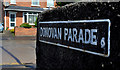
Donovan Parade sign, Belfast
White-on-black sign, with the old postal district number, at the Ladas Drive end of Donovan Parade.
Image: © Albert Bridge
Taken: 24 May 2011
0.03 miles
2
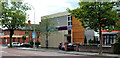
Former Trustee Savings Bank, Belfast (3)
A former branch of the Trustee Savings Bank (later the TSB and later still, the First Trust Bank), now offices, at the corner of the Castlereagh Road (foreground) and Ladas Drive.
Image: © Albert Bridge
Taken: 15 Jul 2011
0.04 miles
3
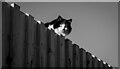
Cat, Belfast
Domestic cat looking over a high fence as seen from the Connswater Greenway Image
Image: © Rossographer
Taken: 16 Jan 2023
0.09 miles
4
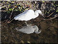
Little Egret, Belfast
Little Egret on the Loop River in Belfast as seen from above on the Connswater Greenway Image
Image: © Rossographer
Taken: 16 Jan 2023
0.09 miles
5
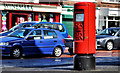
Pillar box, Belfast
EIIR pillar box, at the corner of the Castlereagh Road and Grand Parade (background).
Image: © Albert Bridge
Taken: 24 May 2011
0.09 miles
6
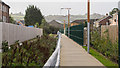
The Connswater Greenway, Belfast
The Greenway alongside the Loop River between the Castlereagh Road and Ladas Drive. Cycling, I had stopped after spotting the unmistakable blue flash of a Kingfisher skimming along the water.
Image: © Rossographer
Taken: 12 Oct 2018
0.10 miles
7
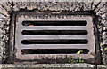
Needham grating cover, Belfast
Image: © Albert Bridge
Taken: 10 Aug 2011
0.10 miles
8
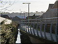
The Connswater Greenway, Belfast
The Greenway alongside the Loop River between the Castlereagh Road and Ladas Drive. Here you can see the clever design of this part of the path which is raised and overhangs the river, allowing wildlife to flourish and humans to pass above. Kingfishers and Egrets are regularly seen here Image
Image: © Rossographer
Taken: 16 Jan 2023
0.10 miles
9
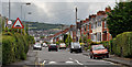
Orby Drive, Belfast (2)
See Image Part of that part of Orby Drive on the other side of Grand Parade.
Image: © Albert Bridge
Taken: 15 Jul 2011
0.12 miles
10
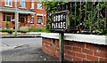
Orby Parade sign, Belfast
I remember reading about some American tourists trying to navigate their way to a B&B in Belfast. What frustrated then was not the absence of street signs but the inconsistency in where they were placed – some were high up on buildings, some were at waist level on posts and some, such as this one, at the Orby Drive Image end of Orby Parade – were very low.
Image: © Albert Bridge
Taken: 10 Aug 2011
0.12 miles