1
Telephone boxes, Woodstock Road, Belfast (April 2018)
Two KX100 telephone boxes outside 281/283 Woodstock Road.
Image: © Albert Bridge
Taken: 13 Apr 2018
0.04 miles
2
Former Willowfield police station, Belfast - April 2018(1)
The Woodstock Road side. The wall hides most of the building.
Image: © Albert Bridge
Taken: 13 Apr 2018
0.04 miles
3
Former Willowfield police station, Belfast - April 2018(2)
The Willowfield Drive side (right) - possibly the only available view of the building.
Image: © Albert Bridge
Taken: 13 Apr 2018
0.05 miles
4
Former Willowfield police station, Belfast - April 2018(3)
A “site closed” sign at the corner of Willowfield Drive (right).
Image: © Albert Bridge
Taken: 13 Apr 2018
0.05 miles
5
Jocelyn Avenue, Belfast
A late 19th century street, running from the Woodstock Road to Euston Street (background), still retaining the original houses.
Image: © Albert Bridge
Taken: 16 Nov 2011
0.08 miles
6
Willowfield (CoI) parish church, Belfast (2)
See
Image The belfry seen from My Lady’s Road
Image An early drawing shows a spire on top although it’s unclear whether it was an unexecuted design or an original feature later removed.
Image: © Albert Bridge
Taken: 22 Dec 2011
0.10 miles
7
Willowfield (CoI) parish church, Belfast (1)
Willowfield (CoI) parish Church, at the corner of the Woodstock Road (foreground) and My Lady’s Road
Image Completed in 1872 to a design by John Lanyon of Lanyon, Lynn and Lanyon. Extended in 1901 by WJ Fennel.
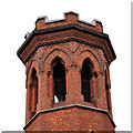
Image shows the belfry.
Image: © Albert Bridge
Taken: 22 Dec 2011
0.10 miles
8
Omeath Street
Omeath Street off the Woodstock Road. Like Greenore Street - it is named after a County Louth village.
Image: © Dean Molyneaux
Taken: 9 Jul 2009
0.10 miles
9
Vacant buildings, Willowfield, Belfast
Houses, converted to shops, now vacant and possibly awaiting redevelopment, at the corner of the Woodstock Road (foreground) and Willowfield Street.
Image: © Albert Bridge
Taken: 5 Nov 2013
0.11 miles
10
"Streetreach" mural, Belfast (2)
See
Image This one is at the My Lady’s Road
Image end of Pearl Street.
Image: © Albert Bridge
Taken: 22 Dec 2011
0.11 miles


