
IMAGES TAKEN NEAR TO
Oakleigh Manor, CRAIGAVON, BT67 9BZ
Introduction
This page details the photographs taken nearby to Oakleigh Manor, BT67 9BZ by members of the Geograph project.
The Geograph project started in 2005 with the aim of publishing, organising and preserving representative images for every square kilometre of Great Britain, Ireland and the Isle of Man.

There are currently over 7.5m images from over14,400 individuals and you can help contribute to the project by visiting https://www.geograph.org.uk
Image Map
Images are licensed for reuse under creativecommons.org/licenses/by-sa/2.0
Notes
- Clicking on the map will re-center to the selected point.
- The higher the marker number, the further away the image location is from the centre of the postcode.
Image Listing (48 Images Found)
Images are licensed for reuse under creativecommons.org/licenses/by-sa/2.0
Image
Details
Distance
1
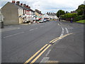
North Street, Lurgan
This is the lower part of North Street at its junction with Oakleigh Heights (right) and Grattan Street (left).
Image: © Dean Molyneaux
Taken: 12 Aug 2010
0.03 miles
2
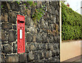
GVIR wall box (BT67 19), Lurgan
A GVIR wall box (BT67 19), at North Street, almost opposite St Peter’s church Image
Image: © Albert Bridge
Taken: 23 Jun 2014
0.10 miles
3
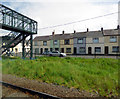
Houses on Brownlow Terrace
At the railway footbridge, viewed from a Belfast bound train.
Image: © Thomas Nugent
Taken: 1 Jun 2019
0.12 miles
4
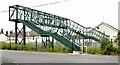
Railway footbridge, Lurgan (June 2014)
A footbridge, across the Belfast – Dublin railway, on the Belfast side of Lurgan station. It re-opened in March 2013 after an extensive refurbishment which included being enclosed by wire mesh.
Image: © Albert Bridge
Taken: 23 Jun 2014
0.13 miles
5
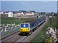
Train approaching Lurgan station
An NIR 80-class DEMU is over Lake Street crossing and approaching Lurgan station with the 13.30 passenger train from Bangor to Portadown.
Image: © The Carlisle Kid
Taken: 23 May 2001
0.14 miles
6
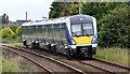
Train approaching Lurgan station (June 2014)
The 09.57 Bangor – Portadown (4003) has just passed Lake Street level crossing and is approaching this footbridge Image and the site of the now-forgotten Dougher level crossing. Image (May 2001) shows how the lineside vegetation has grown in the last 13 years.
Image: © Albert Bridge
Taken: 23 Jun 2014
0.15 miles
7
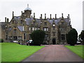
Brownlow House, Lurgan
This is the headquarters of the Royal Black Institution - a Protestant fraternity similar to the Orange Order. A number of Orange Lodges and Black Preceptories meet here - making it the world's largest Orange Hall. Unsurprisingly, it has been attacked on several occasions - including an arson attack which gutted large parts of the building. See also: Image
Image: © Dean Molyneaux
Taken: 18 Aug 2009
0.16 miles
8
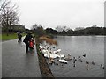
Feeding birds, Lurgan Park (1)
Pictured at Lurgan Lake
Image: © Kenneth Allen
Taken: 26 Dec 2012
0.16 miles
9

Anti-internment graffiti, Lurgan
This graffiti on Lake Street is highlighting the occurrence of 'internment without trial' - which has been a buzzword since its introduction by the British government in 1971. This practice no longer continues however there has been controversy in recent times with regards to the treatment of Irish republican prisoners in Northern Ireland prisons.
Image: © Dean Molyneaux
Taken: 12 Aug 2010
0.16 miles
10
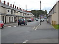
Wellington Street, Lurgan
Looking towards Castle Lane.
Image: © Dean Molyneaux
Taken: 12 Aug 2010
0.16 miles