IMAGES TAKEN NEAR TO
Glenavy Road, CRAIGAVON, BT67 0LT
Introduction
This page details the photographs taken nearby to Glenavy Road, BT67 0LT by members of the Geograph project.
The Geograph project started in 2005 with the aim of publishing, organising and preserving representative images for every square kilometre of Great Britain, Ireland and the Isle of Man.

There are currently over 7.5m images from over14,400 individuals and you can help contribute to the project by visiting https://www.geograph.org.uk
Image Map
Images are licensed for reuse under creativecommons.org/licenses/by-sa/2.0
Notes
- Clicking on the map will re-center to the selected point.
- The higher the marker number, the further away the image location is from the centre of the postcode.
Image Listing (5 Images Found)
Images are licensed for reuse under creativecommons.org/licenses/by-sa/2.0
Image
Details
Distance
1
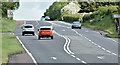
Crawler lane, Magheramesk, Moira (May 2017)
A crawler lane, on the steep ascent from the Moira roundabout http://www.geograph.org.uk/snippet/5410 towards Ballinderry, on the road to Nutt’s Corner Image and Antrim Image The Soldierstown Road http://www.geograph.org.uk/search.php?i=71982718 is at middle left.
There are plans for further improvements to the road which can be busy with lorries during the working week – see http://www.wesleyjohnston.com/roads/a26moiranuttscorner2plus1..html.
Image: © Albert Bridge
Taken: 20 May 2017
0.03 miles
2
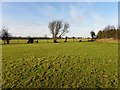
Magheramesk Townland
Looking WNW from Magheramesk Lane
Image: © Kenneth Allen
Taken: 25 Dec 2012
0.16 miles
3
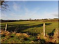
Magheramesk Townland
Looking NNW from Magheramesk Lane
Image: © Kenneth Allen
Taken: 25 Dec 2012
0.21 miles
4
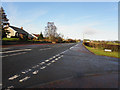
A26, Glenavy Road
Heading north towards the International Airport
Image: © Kenneth Allen
Taken: 25 Dec 2012
0.25 miles
5
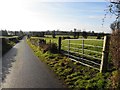
Magheramesk Lane
Heading SSW at Magheramesk
Image: © Kenneth Allen
Taken: 25 Dec 2012
0.25 miles