IMAGES TAKEN NEAR TO
Trummery Lane, CRAIGAVON, BT67 0JN

Introduction

This page details the photographs taken nearby to Trummery Lane, BT67 0JN by members of the Geograph project.

The Geograph project started in 2005 with the aim of publishing, organising and preserving representative images for every square kilometre of Great Britain, Ireland and the Isle of Man.

There are currently over 7.5m images from over14,400 individuals and you can help contribute to the project by visiting https://www.geograph.org.uk

Image Map


Images are licensed for reuse under creativecommons.org/licenses/by-sa/2.0
Notes
  • Clicking on the map will re-center to the selected point.
  • The higher the marker number, the further away the image location is from the centre of the postcode.

Image Listing (8 Images Found)

Images are licensed for reuse under creativecommons.org/licenses/by-sa/2.0
Image
Details
Distance
1
Water-logged field, Trummery
Pictured along Trummery Lane
Image: © Kenneth Allen Taken: 25 Dec 2012
0.12 miles
2
Trummery Lane
Heading north at Trummery
Image: © Kenneth Allen Taken: 25 Dec 2012
0.12 miles
3
088 on Enterprise
Irish Rail 071 Class locomotive #088 on Enterprise service, approaching Trummery Lane road bridge.
Image: © Wilson Adams Taken: 21 Jun 2006
0.14 miles
4
218 on Enterprise
218 has just passed under Trummery Lane road bridge, and is approaching Trummery Crossing grid Image Moira Station is located a short distance around the curve.
Image: © Wilson Adams Taken: 19 Mar 2006
0.14 miles
5
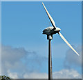
Wind turbine near Maghaberry - April 2016(1)
A wind turbine visible from the Moira – Lisburn Road. Subject position and the following information are taken from the NI Planning Portal “S/2011/0610/F Erection of wind turbine (32.3m hub height, 30m blades). 190m North East of 4b Trummery Lane Maghaberry.” Image shows the blades.
Image: © Albert Bridge Taken: 23 Apr 2016
0.20 miles
6
Wind turbine near Maghaberry - April 2016(2)
See Image The blades from further east along the Lisburn Road.
Image: © Albert Bridge Taken: 23 Apr 2016
0.20 miles
7
The Belfast-Newry railway line from the air
Just north of Moira Station. The A3 Lisburn road runs alongside. Lisburn can be seen in the distance.
Image: © Thomas Nugent Taken: 9 Dec 2019
0.22 miles
8
Maghaberry Townland
Looking ENE from Trummery Lane
Image: © Kenneth Allen Taken: 25 Dec 2012
0.25 miles