
IMAGES TAKEN NEAR TO
Carrickvale Avenue, CRAIGAVON, BT66 8NW
Introduction
This page details the photographs taken nearby to Carrickvale Avenue, BT66 8NW by members of the Geograph project.
The Geograph project started in 2005 with the aim of publishing, organising and preserving representative images for every square kilometre of Great Britain, Ireland and the Isle of Man.

There are currently over 7.5m images from over14,400 individuals and you can help contribute to the project by visiting https://www.geograph.org.uk
Image Map
Images are licensed for reuse under creativecommons.org/licenses/by-sa/2.0
Notes
- Clicking on the map will re-center to the selected point.
- The higher the marker number, the further away the image location is from the centre of the postcode.
Image Listing (6 Images Found)
Images are licensed for reuse under creativecommons.org/licenses/by-sa/2.0
Image
Details
Distance
1
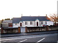
St. John's Parish Church (C of I), Sloan Street, Lurgan
Image: © P Flannagan
Taken: 18 Nov 2007
0.12 miles
2
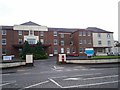
Lurgan Hospital, Sloan Street, Lurgan
This hospital was originally the Lurgan Workhouse. In 1929 it became Lurgan and Portadown District Hospital. Since 1972, when Craigavon Hospital was built, it became known as Lurgan Hospital.
Image: © P Flannagan
Taken: 14 Oct 2007
0.20 miles
3
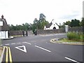
Entrance to Lurgan Cemetery, New Line Road.
This cemetery, opened in 1863, replaced the old Shankhill graveyard in Shankhill Road, Lurgan, which had been in use since around the 1690s.
Image: © P Flannagan
Taken: 19 Aug 2007
0.21 miles
4

The A3, Lurgan
The A3 at Lurgan, heading towards Portadown.
Image: © Rossographer
Taken: 3 Aug 2025
0.23 miles
5
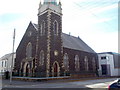
Hill Street Presbyterian Church, Lurgan
http://www.hillstreetchurch.net/about_us_history.htm
Image: © P Flannagan
Taken: 5 Oct 2007
0.24 miles
6
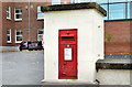
GR wall box, Lurgan
GR wall box (BT66 32) at Lurgan Hospital, Sloan Street.
Image: © Albert Bridge
Taken: 9 Nov 2012
0.25 miles