
IMAGES TAKEN NEAR TO
William Street, CRAIGAVON, BT66 6JB
Introduction
This page details the photographs taken nearby to William Street, BT66 6JB by members of the Geograph project.
The Geograph project started in 2005 with the aim of publishing, organising and preserving representative images for every square kilometre of Great Britain, Ireland and the Isle of Man.

There are currently over 7.5m images from over14,400 individuals and you can help contribute to the project by visiting https://www.geograph.org.uk
Image Map
Images are licensed for reuse under creativecommons.org/licenses/by-sa/2.0
Notes
- Clicking on the map will re-center to the selected point.
- The higher the marker number, the further away the image location is from the centre of the postcode.
Image Listing (34 Images Found)
Images are licensed for reuse under creativecommons.org/licenses/by-sa/2.0
Image
Details
Distance
1
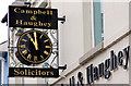
Clock, Lurgan (2)
Ornamental clock at a solicitors’ office in William Street.
Image: © Albert Bridge
Taken: 20 Feb 2011
0.04 miles
2
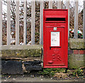
Letter box, Lurgan
Ground-level and wall-mounted EIIR letter box in William Street.
Image: © Albert Bridge
Taken: 20 Feb 2011
0.05 miles
3
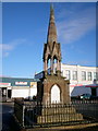
Millar Memorial, William Street, Lurgan
The Millar memorial erected around 1860 in memory of Rev Thomas Millar who was born in Cookstown, Co. Tyrone in 1819 and in 1844 he received "a call" to First Lurgan Presbyterian Church. He promoted a school attached to the church and in 1850 he was installed as President of Lurgan Literary Society. He died tragically in the Trent rail disaster of 1858. See Image]
Image: © P Flannagan
Taken: 18 Nov 2007
0.06 miles
4
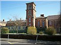
Lurgan Model Primary School
Situated near Brownlow Terrace, it was opened in 1863.
Image: © P Flannagan
Taken: 13 Apr 2008
0.06 miles
5
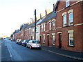
Brownlow Terrace, Lurgan
These houses were constructed in the 1850's as dwellings for workers at the Lurgan Weaving Company next door in Ulster Street. See Image]
Image: © P Flannagan
Taken: 18 Nov 2007
0.06 miles
6
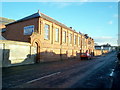
Old Lurgan Weaving Factory, Ulster Street, Lurgan
The Lurgan Weaving Company (Malcolm's Weaving Factory), or "The Limited", as it became known, built around 1880, is another fine example of Lurgan's industrial architecture. A Mr. William Reason Woodford was a London agent, circa late 1930’s for both The Lurgan Weaving Co. and Johnston, Allen & Co in Victoria St. also in Lurgan. He obtained orders for the large stores in London such as Bourne & Hollingsworth, Pointings, C&A’s etc. He suggested that sets of colourful embroidered napkins and tea towels in the 100% linen would be introduced using “London Scenes” and “London Tourist Sites”. Examples of these were Windsor Castle, Buckingham Palace, St.Paul’s Cathedral, Trafalgar Square and St. James’s Palace. It is not known which of these companies he worked for when these sets of napkins and the tea towels were put into production but they became huge sellers for that company. The tea towel cost around 3/11d at that time. See Image Also see Image
Image: © P Flannagan
Taken: 18 Nov 2007
0.07 miles
7
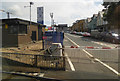
William Street, Lurgan
Viewed from a Belfast bound train on the level crossing at Lurgan station.
Image: © Thomas Nugent
Taken: 1 Jun 2019
0.07 miles
8
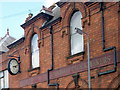
Canavan Clock
This old Lurgan Weaving Factory has had changes of use over the years. At one time the Canavan Clock Makers used part of it.
Image: © P Flannagan
Taken: 18 Nov 2007
0.07 miles
9
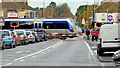
William Street level crossing, Lurgan
See Image (May 1974). William Street level crossing is now locally-operated full barriers. Under the regular interval service up and down Portadown-Bangor trains call at Lurgan at the same times. The crossing is on the road from the centre of the town to the M1. The queue of vehicles, at the crossing, builds up very quickly – on both sides. The train is the 10.27 Bangor – Portadown.
Image: © Albert Bridge
Taken: 9 Nov 2012
0.08 miles
10
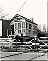
Lurgan signal cabin
The signal cabin, on the Portadown/Dublin side of William Street level crossing at Lurgan station, controlled the Lurgan-Moira and Lurgan-Portadown block sections and the manually operated level crossing gates. It was later destroyed by a bomb. The crossing now has full barriers. See Image (November 2012).
Image: © Albert Bridge
Taken: 4 May 1974
0.08 miles