IMAGES TAKEN NEAR TO
Millbrook Mews, CRAIGAVON, BT66 6HF
Introduction
This page details the photographs taken nearby to Millbrook Mews, BT66 6HF by members of the Geograph project.
The Geograph project started in 2005 with the aim of publishing, organising and preserving representative images for every square kilometre of Great Britain, Ireland and the Isle of Man.

There are currently over 7.5m images from over14,400 individuals and you can help contribute to the project by visiting https://www.geograph.org.uk
Image Map
Images are licensed for reuse under creativecommons.org/licenses/by-sa/2.0
Notes
- Clicking on the map will re-center to the selected point.
- The higher the marker number, the further away the image location is from the centre of the postcode.
Image Listing (4 Images Found)
Images are licensed for reuse under creativecommons.org/licenses/by-sa/2.0
Image
Details
Distance
2
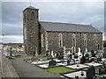
Seagoe Parish Catholic Church
In the townland of Derrymacash.
Image: © Brian Shaw
Taken: 27 Feb 2006
0.20 miles
3
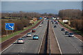
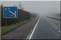
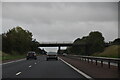
The M1 at Derrymacash
This section of the M1, between Lurgan and Ballynacor, near Portadown, opened in 1967. This is the view towards Lurgan and Belfast. Much of the land here (close to Lough Neagh) is flat and the view extends almost as far Belfast (the hills in the distance are to the south west of Belfast).
Image: © Albert Bridge
Taken: 1 Mar 2007
0.20 miles