IMAGES TAKEN NEAR TO
Glenloughan Park, CRAIGAVON, BT63 6LP
Introduction
This page details the photographs taken nearby to Glenloughan Park, BT63 6LP by members of the Geograph project.
The Geograph project started in 2005 with the aim of publishing, organising and preserving representative images for every square kilometre of Great Britain, Ireland and the Isle of Man.

There are currently over 7.5m images from over14,400 individuals and you can help contribute to the project by visiting https://www.geograph.org.uk
Image Map
Images are licensed for reuse under creativecommons.org/licenses/by-sa/2.0
Notes
- Clicking on the map will re-center to the selected point.
- The higher the marker number, the further away the image location is from the centre of the postcode.
Image Listing (132 Images Found)
Images are licensed for reuse under creativecommons.org/licenses/by-sa/2.0
Image
Details
Distance
1

Flowers in a tub, Scarva
Pictured along Gilford Road
Image: © Kenneth Allen
Taken: 9 Jul 2012
0.02 miles
2

B3 Gilford Road, Scarva
Heading NNE to Gilford / Banbridge
Image: © Kenneth Allen
Taken: 9 Jul 2012
0.04 miles
3

Bus, Scarva (2)
Ulsterbus Alexander-bodied Leyland Tiger arriving in Scarva with the 11.45 from Banbridge. For the return see Image
Image: © Albert Bridge
Taken: 31 May 2010
0.04 miles
4
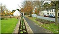
Late autumn at Scarva
The view, along Main Street, towards Banbridge and Gilford. Now lacking the colour of the high-summer flower beds Image
Image: © Albert Bridge
Taken: 9 Nov 2008
0.05 miles
5

Piles, Scarva
Something started here and not proceeded with - I guess the ground along the disused canal poses problems for foundations.
Image: © Kenneth Allen
Taken: 9 Jul 2012
0.06 miles
6
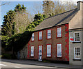
Former police barracks, Scarva
See Image No change since the last photo. The “At risk” register describes it as “A two-storey, four-bay former constabulary barracks, sited at the end of a long terrace of listed buildings in the small canal village of Scarva. Unfortunately, pebble-dashed, and with all of its openings boarded up, it was last used as a dwelling house, but has been uninhabited for well over a decade (it appeared in Buildings at Risk, Vol. 2, p. 33). A substantial property with a large wooded walled garden, it would seem a highly attractive proposition for a restoring owner”.
Image: © Albert Bridge
Taken: 14 Apr 2010
0.06 miles
7
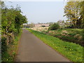
Terraced housing Apartments at Scarvagh Locks
This modern development is located between the Newry Canal and Gilford Road.
Image: © Eric Jones
Taken: 18 Apr 2019
0.07 miles
8

"Best of the best, Scarva" sign
Pictured along Gilford Road
Image: © Kenneth Allen
Taken: 9 Jul 2012
0.07 miles
9

Scarvagh Heights, Scarva
Pictured along Gilford Road
Image: © Kenneth Allen
Taken: 9 Jul 2012
0.07 miles