IMAGES TAKEN NEAR TO
Derrycor Road, CRAIGAVON, BT62 1NR
Introduction
This page details the photographs taken nearby to Derrycor Road, BT62 1NR by members of the Geograph project.
The Geograph project started in 2005 with the aim of publishing, organising and preserving representative images for every square kilometre of Great Britain, Ireland and the Isle of Man.

There are currently over 7.5m images from over14,400 individuals and you can help contribute to the project by visiting https://www.geograph.org.uk
Image Map
Images are licensed for reuse under creativecommons.org/licenses/by-sa/2.0
Notes
- Clicking on the map will re-center to the selected point.
- The higher the marker number, the further away the image location is from the centre of the postcode.
Image Listing (6 Images Found)
Images are licensed for reuse under creativecommons.org/licenses/by-sa/2.0
Image
Details
Distance
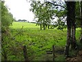
1

Sandy Rampart, Derrycor
Heading west from Derrycor Road
Image: © Kenneth Allen
Taken: 28 Jun 2011
0.13 miles
2
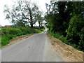
Country road, Derrycor
Pictured at the junction with Sandy Rampart
Image: © Kenneth Allen
Taken: 28 Jun 2011
0.15 miles

6
Derrycor Road Mobile
Another transmitter mast providing service to the main M1 corridor.
Image: © Raymond Okonski
Taken: 25 Sep 2007
0.25 miles