
IMAGES TAKEN NEAR TO
Parkside, CRAIGAVON, BT62 1DB
Introduction
This page details the photographs taken nearby to Parkside, BT62 1DB by members of the Geograph project.
The Geograph project started in 2005 with the aim of publishing, organising and preserving representative images for every square kilometre of Great Britain, Ireland and the Isle of Man.

There are currently over 7.5m images from over14,400 individuals and you can help contribute to the project by visiting https://www.geograph.org.uk
Image Map
Images are licensed for reuse under creativecommons.org/licenses/by-sa/2.0
Notes
- Clicking on the map will re-center to the selected point.
- The higher the marker number, the further away the image location is from the centre of the postcode.
Image Listing (91 Images Found)
Images are licensed for reuse under creativecommons.org/licenses/by-sa/2.0
Image
Details
Distance
2
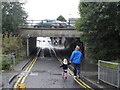
The Tunnel leading to Obin Street
The bridge carries Northway Bypass
Image: © HENRY CLARK
Taken: 19 Sep 2009
0.09 miles
3
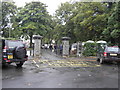
Entrance to the People's Park, Portadown
Image: © HENRY CLARK
Taken: 19 Sep 2009
0.09 miles
4
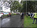
Country comes to town fair 2009 Portadown
People's Park
Image: © HENRY CLARK
Taken: 19 Sep 2009
0.09 miles
5
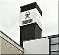
Railway station clock, Portadown (May 2016)
The digital clock at the Obins Street entrance to Portadown station Image
Image: © Albert Bridge
Taken: 5 May 2016
0.09 miles
6
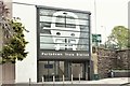
Entrance, Portadown station (May 2016)
See Image (May 2012). The Obins Street entrance to the rebuilt Portadown station. The building now complies with disabled access law by having a lift inside (hidden to the left). The original NIR station(1970) here had a bar/refreshment room (upstairs) which closed after bomb damage. For comparison see Image (October 1970) and Image (December 1970).
Image: © Albert Bridge
Taken: 5 May 2016
0.09 miles
7
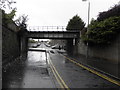
Railway bridge at the Tunnel
This bridge carries the Belfast to Dublin line
Image: © HENRY CLARK
Taken: 19 Sep 2009
0.09 miles
8

Snow on Obins Street, Portadown
The view that one is greeted with upon leaving Portadown Railway Station.
Image: © Dean Molyneaux
Taken: 6 Jan 2010
0.09 miles
9
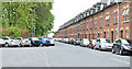
Park Road, Portadown
A street, between the park (left) and the railway (behind the houses), running from Obins Street to the Garvaghy Road. Many of the houses have attics. Image shows a similar view in September 2009.
Image: © Albert Bridge
Taken: 20 May 2013
0.09 miles
10
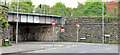
"The Tunnel" railway bridge, Portadown
The railway bridge, across Obins Street, at the Dublin end of Portadown station. The area is commonly known as “The Tunnel”. The street was closed, under the bridge, during The Troubles/The Armed Struggle but was subsequently re-opened for one-way traffic.
Image: © Albert Bridge
Taken: 20 May 2013
0.09 miles