IMAGES TAKEN NEAR TO
Sleepy Valley, ARMAGH, BT61 9QY
Introduction
This page details the photographs taken nearby to Sleepy Valley, BT61 9QY by members of the Geograph project.
The Geograph project started in 2005 with the aim of publishing, organising and preserving representative images for every square kilometre of Great Britain, Ireland and the Isle of Man.

There are currently over 7.5m images from over14,400 individuals and you can help contribute to the project by visiting https://www.geograph.org.uk
Image Map
Images are licensed for reuse under creativecommons.org/licenses/by-sa/2.0
Notes
- Clicking on the map will re-center to the selected point.
- The higher the marker number, the further away the image location is from the centre of the postcode.
Image Listing (38 Images Found)
Images are licensed for reuse under creativecommons.org/licenses/by-sa/2.0
Image
Details
Distance
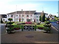
2
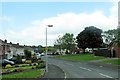
Millview Park, Richhill
The image was taken from Corcreevy Road.
Image: © Eric Jones
Taken: 4 Jun 2016
0.15 miles
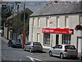
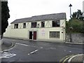
4
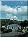
Good Food Express / Wilson Audio, Richhill
They are located at Main Street
Image: © Kenneth Allen
Taken: 9 Jun 2011
0.20 miles
5
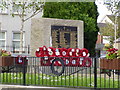
Richhill War Memorial
This War Memorial and enclosed garden is situated at the bottom of Main Street in this well known County Armagh Village.
Image: © P Flannagan
Taken: 4 Feb 2008
0.20 miles
6
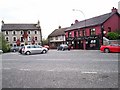
D.U.P. Advice Centre, Richhill
Democratic Unionist Party office on Main Street in Richhill village. The seasonal Orange Arch is partially visible to the left.
Image: © Dean Molyneaux
Taken: 24 Jul 2009
0.20 miles
7
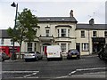
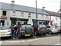
Town house, Richhill
It is located at Main Street
Image: © Kenneth Allen
Taken: 9 Jun 2011
0.20 miles
8
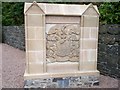
Richardson coat of arms 2
The monument, which has been relocated to the grounds of St. Matthew's Parish Church in the Square, is believed to date back to the 1770s. It had been sited in the wall of a silo on the farm of Mr Robin Lamb, a local farmer and landowner, for many years. He bequeathed it to the village about eight years ago. Richhill Improvement Association decided to have it restored to its former glory. It was transported to the Moira depot of the Northern Ireland Environment Agency for restoration. The Richardson family lived at Richhill Castle from the mid-1600s and the area became known as Richardson's Hill, later shortened to Richhill, with the original name of Legacorry being abandoned. See Image Anne Sacheverell, the only surviving child of Francis, the younger, who died in 1649 and owned Mulladry Castle Richhill, inherited the castle. About the year 1654 Anne married Edward Richardson, a major in the army who came to Ireland in 1642.
Image: © P Flannagan
Taken: 26 Sep 2009
0.21 miles
10
The Normandy Inn, Richhill
It is located at Main Street
Image: © Kenneth Allen
Taken: 9 Jun 2011
0.22 miles