1
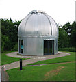
Armagh Planetarium on the Portadown Road
The Armagh Planetarium was opened in 1968
Image: © Eric Jones
Taken: 4 Jun 2016
0.01 miles
2
Armagh Planetarium
Set in the grounds of the old Observatory, the Planetarium was opened in 1968.
Image: © P Flannagan
Taken: 25 Aug 2007
0.03 miles
3
Modern telescope house in the grounds of the Armagh Observatory
This one of a pair of domes in the grounds of the observatory.
Image: © Eric Jones
Taken: 3 Jun 2016
0.04 miles
4
Weather Station, Armagh
The weather station at the Armagh Observatory. Much of this is now automated, but readings are also taken manually each day. Meteorological records have been taken here since 1794. See http://climate.arm.ac.uk/contents.html for more information.
Image: © Rossographer
Taken: 16 Jun 2010
0.04 miles
5
Telescope, Armagh Observatory
One of several telescopes (hidden inside the telescope house) at the Armagh Observatory.
Image: © Rossographer
Taken: 16 Jun 2010
0.05 miles
6
The weather station enclosure at the Armagh Observatory
The Armagh Automatic weather station measures Air temperature, Rainfall, Barometric Pressure, Sunshine, Wind Speed and Wind Direction. The station is owned by the Met Office. Armagh Observatory's weather data extends unbroken back to 1844, with air tempeartaure readings reaching back to 1795.
Image: © Eric Jones
Taken: 3 Jun 2016
0.05 miles
7
View east towards the weather station and telescope dome at Armagh Observatory
Image: © Eric Jones
Taken: 3 Jun 2016
0.05 miles
8
Telescope dome in the grounds of Armagh Observatory
Image: © Eric Jones
Taken: 3 Jun 2016
0.06 miles
9
Telescope in one of the outside domes in the grounds of the Armagh Observatory
Image: © Eric Jones
Taken: 3 Jun 2016
0.06 miles
10
Looking westwards towards the buildings of The Royal School
Located on the Portadown Road, The Royal School, a co-educational grammar school was established by royal decree in 1608 and moved to its present 27 acre site in the 1770s. It remained a boys' school until 1986 when it amalgamated with Armagh Girls' High School to become a co-educational school
Image: © Eric Jones
Taken: 4 Jun 2016
0.06 miles


