
IMAGES TAKEN NEAR TO
Manor Farm, ARMAGH, BT61 8JB
Introduction
This page details the photographs taken nearby to Manor Farm, BT61 8JB by members of the Geograph project.
The Geograph project started in 2005 with the aim of publishing, organising and preserving representative images for every square kilometre of Great Britain, Ireland and the Isle of Man.

There are currently over 7.5m images from over14,400 individuals and you can help contribute to the project by visiting https://www.geograph.org.uk
Image Map
Images are licensed for reuse under creativecommons.org/licenses/by-sa/2.0
Notes
- Clicking on the map will re-center to the selected point.
- The higher the marker number, the further away the image location is from the centre of the postcode.
Image Listing (21 Images Found)
Images are licensed for reuse under creativecommons.org/licenses/by-sa/2.0
Image
Details
Distance
1
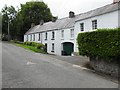
Worker's houses, Loughgall
They are located off Main Street. Major employers were the Cope families
In 1610, the Plantation of Ulster (under James I of England) came into effect. The manors of Loughgall and Carrobrack were granted to Lord Saye and Sele. In 1611 he sold these lands to Sir Anthony Cope of which 3,000 acres were represented by the Manor of Loughgall.
The Copes were an old established English family from Hanwell, Oxfordshire.
The two Cope families of the Manor House and Drumilly respectively, did not take a very active part in politics, but as residential landlords pursued a policy of development of agriculture both on their own estates and greatly encouraged the improvement and fertility of the farms of their tenants. Apple growing over the past two centuries has become a major factor in the economic development of Co. Armagh, with Loughgall the heart of this important industry.
Image: © Kenneth Allen
Taken: 9 Jun 2011
0.19 miles
2
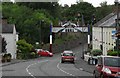
Orange Arch, Loughgall
The seasonal Orange Arch in Loughgall village. As a matter of interest, the Orange Order itself was founded at the Diamond - two miles from here - by local man Dan Winter in 1795. The village therefore is often regarded as the home of the Order.
Image: © Dean Molyneaux
Taken: 26 Jul 2009
0.20 miles
4
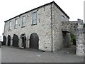
Former market house
The judge would enter the building at the rear and when arrived, he would have enjoyed a warm coal fire and a hot meal would have been prepared for him. The court proceedings were heard on the first floor. Most cases were of a petty nature.
Image: © Kenneth Allen
Taken: 9 Jun 2011
0.20 miles
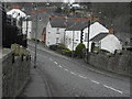
6
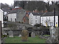
Graveyard, St. Luke's Old Parish Church, Loughgall
Image: © HENRY CLARK
Taken: 3 Apr 2010
0.21 miles
7
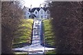
Loughgall Manor Estate
AFBI Loughgall,Manor House,Loughgall,
Image: © HENRY CLARK
Taken: 8 Feb 2009
0.21 miles
8
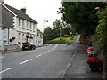
Main Street, Loughgall
The Main Street leaving Loughgall village - looking towards the Red Lion and Portadown.
Image: © Dean Molyneaux
Taken: 26 Jul 2009
0.21 miles
9
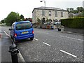
Main Street, Loughgall
Heading north-east; on the right is the former courthouse and market house
Image: © Kenneth Allen
Taken: 9 Jun 2011
0.21 miles
10
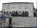
Loughgall Market House
Built in 1746, the upper storey was used as a court room.
Now there is an antique shop and a salon.
My attention was drawn to the inscription on a post here Image]
More at http://irishantiquities.bravehost.com/armagh/loughgall/loughgallMH.html
Image: © Kenneth Allen
Taken: 9 Jun 2011
0.22 miles