IMAGES TAKEN NEAR TO
Spires Retail Park, Moy Road, ARMAGH, BT61 8DB
Introduction
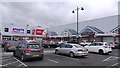
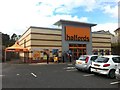
This page details the photographs taken nearby to Spires Retail Park, Moy Road, BT61 8DB by members of the Geograph project.
The Geograph project started in 2005 with the aim of publishing, organising and preserving representative images for every square kilometre of Great Britain, Ireland and the Isle of Man.

There are currently over 7.5m images from over14,400 individuals and you can help contribute to the project by visiting https://www.geograph.org.uk
Image Map
Images are licensed for reuse under creativecommons.org/licenses/by-sa/2.0
Notes
- Clicking on the map will re-center to the selected point.
- The higher the marker number, the further away the image location is from the centre of the postcode.
Image Listing (5 Images Found)
Images are licensed for reuse under creativecommons.org/licenses/by-sa/2.0
Image
Details
Distance
3
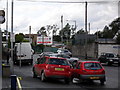
Loughgall Road, Armagh
The Loughgall Road in Armagh - the old G.N.R. (I) railway station was where the 'Ulsterbus' sign (extreme right) is today. Interestingly, Armagh was one of the first towns in Ireland to be served by rail in 1848 - and also one of the first to lose its services in 1957.
Image: © Dean Molyneaux
Taken: 24 Jul 2009
0.12 miles
4
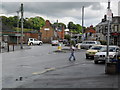
Railway Street, Armagh
Along Railway Street looking towards the city centre and Lonsdale Road.
Image: © Dean Molyneaux
Taken: 24 Jul 2009
0.17 miles
5
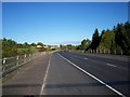
Moy Road, Armagh
The bridge on the left of the photograph is crossing the River Callan
Image: © P Flannagan
Taken: 17 Oct 2007
0.22 miles