IMAGES TAKEN NEAR TO
Glencregagh Court, BELFAST, BT6 0PA
Introduction
This page details the photographs taken nearby to Glencregagh Court, BT6 0PA by members of the Geograph project.
The Geograph project started in 2005 with the aim of publishing, organising and preserving representative images for every square kilometre of Great Britain, Ireland and the Isle of Man.

There are currently over 7.5m images from over14,400 individuals and you can help contribute to the project by visiting https://www.geograph.org.uk
Image Map
Images are licensed for reuse under creativecommons.org/licenses/by-sa/2.0
Notes
- Clicking on the map will re-center to the selected point.
- The higher the marker number, the further away the image location is from the centre of the postcode.
Image Listing (9 Images Found)
Images are licensed for reuse under creativecommons.org/licenses/by-sa/2.0
Image
Details
Distance
1
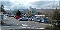
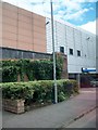
Forestside Shopping Centre, Newtownbreda
Image: © Michael Parry
Taken: 19 Apr 2005
0.05 miles
2
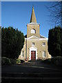
Knockbreda Parish Church
Built to the design of Richard Cassels in 1737, it is the oldest Church in the Belfast area.
Image: © Brian Shaw
Taken: 1 Nov 2005
0.05 miles
3
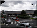
Forestside Shopping Centre
Opened in 1997 on the site of the Supermac supermarket on Upper Galwally. M&S and Sainsbury's are the anchor tenants.
Image: © Dean Molyneaux
Taken: 9 Jul 2009
0.16 miles
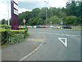
4
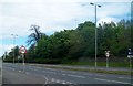
Upper Knockbreda Road from its junction with Saintfield Road
Image: © Eric Jones
Taken: 27 Apr 2012
0.18 miles
5
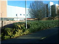
Stores at the Forestside Shopping Centre off the A24
Image: © Eric Jones
Taken: 7 Dec 2018
0.19 miles
6
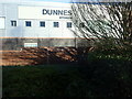
Dunnes Stores at the Forestside Shopping Centre
The image was taken from the A24.
Image: © Eric Jones
Taken: 7 Dec 2018
0.20 miles
7
Upper Galwally
Upper Galwally, which links the A55 dual-carriageway with the Ormeau Road.
Image: © Dean Molyneaux
Taken: 9 Jul 2009
0.22 miles
8
Entrance to covered car park at Belfast Forestside Shopping Centre
Image: © Eric Jones
Taken: 27 Apr 2012
0.22 miles
9
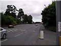
The A24 crossroads on the A55 (Upper Knockbreda Road)
The A55 road forms Belfast's outer-ring road.
Image: © Eric Jones
Taken: 21 Jun 2019
0.22 miles