1
Houses between Killylea Road and St Patrick's CoI Cathedral
These are mixture of Georgian, Victorian and Modern houses.
Image: © Eric Jones
Taken: 1 Jun 2016
0.08 miles
2
St Brigid's School from Nursery Road
This is a small non-selective boys' secondary school with an enrolment of about 190 pupils. In 2015 it was decided that St Brigid's was unsustainable and to amalgamate it with St Patrick's Grammar School which would then cease to be a selective school. St Brigid's will be closed in August 2016.
http://www.belfasttelegraph.co.uk/news/education/head-loses-fight-to-keep-grammar-school-armagh-principal-opposed-change-he-must-now-accept-30080562.html
http://armaghi.com/tag/st-brigids-high-school/
Image]
Image: © Eric Jones
Taken: 1 Jun 2016
0.11 miles
3
Ruined windmill on Windmill Hill, Armagh
http://www.armaghhistorygroup.com/uploads/cms_file/210420111378.pdf
Image: © Eric Jones
Taken: 2 Aug 2012
0.12 miles
4
Topaz Filling Station on the corner of Nursery Road and Killylea Road
Image: © Eric Jones
Taken: 1 Jun 2016
0.12 miles
5
Ruined wind mill on Windmill Hill, Armagh
The Armagh Windmill dates from 1810 and operated as a flour mill until the 1860s when it was badly damaged by fire.
Image: © Eric Jones
Taken: 1 Jun 2016
0.12 miles
6
Mount St Catherine's Primary School, Windmill Hill, Armagh
Mount St Catherine's Primary is a state-funded Catholic ethos school and is part of The Sacred Heart Network of Schools. It was established in 1851 and today has over 200 pupils largely drawn from the surrounding housing estates.
Image: © Eric Jones
Taken: 1 Jun 2016
0.13 miles
7
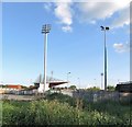
Grandstand at the Pearce ?g GAA Club, Armagh
Since 2007, the Pearse Óg GAA Club which was formed in the 1950s, has developed this site on the western outskirts of Armagh building a new stadium and a clubhouse. The ground is known in Irish as Pearse Óg Parkhis.
http://www.pearseoggfc.com/index.php/club-information/club-history
Image: © Eric Jones
Taken: 1 Jun 2016
0.13 miles
8
St Brigid's High School, Armagh
This is a small non-selective boys' secondary school with an enrolment of about 190 pupils. In 2015 it was decided that St Brigid's was unsustainable and to amalgamate it with St Patrick's Grammar School which would then cease to be a selective school. St Brigid's will be closed in August 2016.
http://www.belfasttelegraph.co.uk/news/education/head-loses-fight-to-keep-grammar-school-armagh-principal-opposed-change-he-must-now-accept-30080562.html
http://armaghi.com/tag/st-brigids-high-school/
Image]
Image: © Eric Jones
Taken: 1 Jun 2016
0.13 miles
9
Sub-urban housing estates on the south side of Armagh
The image was taken from near the Anglican Cathedral.
Image: © Eric Jones
Taken: 1 Jun 2016
0.13 miles
10
St Patrick's Cathedral perspective, Armagh
Image: © Chris Burrell
Taken: 23 Jan 2000
0.14 miles


