IMAGES TAKEN NEAR TO
Lisnalee Park, ARMAGH, BT60 2UP
Introduction
This page details the photographs taken nearby to Lisnalee Park, BT60 2UP by members of the Geograph project.
The Geograph project started in 2005 with the aim of publishing, organising and preserving representative images for every square kilometre of Great Britain, Ireland and the Isle of Man.

There are currently over 7.5m images from over14,400 individuals and you can help contribute to the project by visiting https://www.geograph.org.uk
Image Map
Images are licensed for reuse under creativecommons.org/licenses/by-sa/2.0
Notes
- Clicking on the map will re-center to the selected point.
- The higher the marker number, the further away the image location is from the centre of the postcode.
Image Listing (11 Images Found)
Images are licensed for reuse under creativecommons.org/licenses/by-sa/2.0
Image
Details
Distance
1
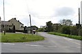
Drumnahunshin Road at its junction with the B113 at Lisnalea
Image: © Eric Jones
Taken: 15 May 2012
0.03 miles
2
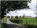
The Drumnahunshin Road approaching the village of Lisnalea
Image: © Eric Jones
Taken: 15 May 2012
0.03 miles
3

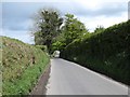
Markethill to Bessbrook Road
This is the B133 at Lisnalee Park.
Image: © P Flannagan
Taken: 26 Apr 2008
0.04 miles
4
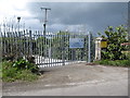
Lisnalea Waste Water Treatment Works, Lisnalea, Bessbrook
Image: © Eric Jones
Taken: 15 May 2012
0.04 miles
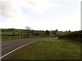
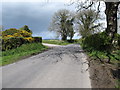
5
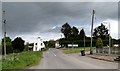
The Lisnalee Cross Roads
Here at the hamlet of Lisnalee the Drumnahunshin Road intersects the busy B133 Bessbrook Road.
Image: © Eric Jones
Taken: 15 May 2012
0.05 miles
6
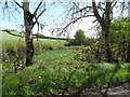
Wetland south-west of the South Armagh village of Lisnalea
Image: © Eric Jones
Taken: 15 May 2012
0.05 miles
7
The Drumnahunshin Road south-west of the village of Lisnalea
Image: © Eric Jones
Taken: 15 May 2012
0.06 miles
8
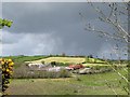
Gathering hail storm behind a drumlin on Lisnalee Road
Image: © Eric Jones
Taken: 15 May 2012
0.08 miles
10
Junction with a farm lane on the Drumnahunshin Road
This is located outdie Lisnalea.
Image: © Eric Jones
Taken: 15 May 2012
0.22 miles