
IMAGES TAKEN NEAR TO
Barnetts Crescent, BELFAST, BT5 7BQ
Introduction
This page details the photographs taken nearby to Barnetts Crescent, BT5 7BQ by members of the Geograph project.
The Geograph project started in 2005 with the aim of publishing, organising and preserving representative images for every square kilometre of Great Britain, Ireland and the Isle of Man.

There are currently over 7.5m images from over14,400 individuals and you can help contribute to the project by visiting https://www.geograph.org.uk
Image Map
Images are licensed for reuse under creativecommons.org/licenses/by-sa/2.0
Notes
- Clicking on the map will re-center to the selected point.
- The higher the marker number, the further away the image location is from the centre of the postcode.
Image Listing (58 Images Found)
Images are licensed for reuse under creativecommons.org/licenses/by-sa/2.0
Image
Details
Distance
1

Development site, 57 Barnett's Road, Belfast (2013-2)
The Barnett’s Road frontage.
Image: © Albert Bridge
Taken: 29 Aug 2013
0.04 miles
2
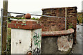
Old gate pillar, Belfast
An old gate pillar at 57 Barnett’s Road.
Image: © Albert Bridge
Taken: 10 Oct 2011
0.04 miles
3
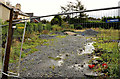
Development site, 57 Barnett's Road, Belfast (2011)
A vacant site, close to Barnett’s Crescent and Thornhill Drive Image
Image: © Albert Bridge
Taken: 10 Oct 2011
0.04 miles
4
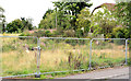
Vacant site, Barnett's Road, Belfast (2013)
The site of a house, on the northern side of Barnett’s Road between Thornhill Drive and Thornhill Grove, cleared for a development which has still to happen.
Image: © Albert Bridge
Taken: 29 Aug 2013
0.04 miles
5
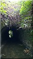
BCDR third culvert over Knock River (upstream end)
The Belfast and County Down Railway track between Belfast and Comber, now the Comber Greenway, required three culverts to maintain the flow of the Knock River. This is the upstream end of the third culvert.
Image: © Alan Collins
Taken: 27 Nov 2013
0.05 miles
6
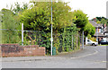
Development site, 57 Barnett's Road, Belfast (2013-1)
The site, hidden by several years of tree growth, with Barnett’s Crescent on the right.
Image: © Albert Bridge
Taken: 29 Aug 2013
0.05 miles
7

Ivy flowers, Belfast
Ivy flowers growing along this part of the Comber Greenway Image
Image: © Albert Bridge
Taken: 10 Oct 2011
0.05 miles
8
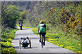
Comber Greenway
Cyclists on the greenway. On the left is what I assume to be a disabled cyclist on a hand-cranked recumbent tricycle. They passed me,on my Brompton folding bike, at a fair pace.
Image: © Robert Ashby
Taken: 22 Apr 2015
0.05 miles
9
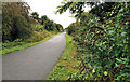
The Comber Greenway, Belfast (8)
A stretch of the Comber Greenway (formerly the Belfast and County Down railway – closed 1950) to the east of the Kings Road – in the distance). There has been a long-standing (and much opposed) proposal to convert it to a guided busway. On 7 October 2011 the BBC reported “It is understood the formal announcement not to use the Comber Greenway as part of a rapid bus transit system will be made next week”. This is a Geograph example of a guided busway http://www.geograph.org.uk/snippet/679. This You Tube link shows one in operation http://www.youtube.com/watch?v=vPhhbF0Ms7g&feature=results_main&playnext=1&list=PLCFA177369D8C38E8.
Image: © Albert Bridge
Taken: 10 Oct 2011
0.06 miles
10
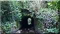
BCDR third culvert over Knock River (downstream end)
BCDR third culvert over Knock River (downstream end)
The Belfast and County Down Railway track between Belfast and Comber, now the Comber Greenway, required three culverts to maintain the flow of the Knock River. This is the downstream end of the third culvert.
Image: © Alan Collins
Taken: 11 Dec 2013
0.06 miles