1
The King's Road, Belfast (2)
A long suburban road, running from the Sandown Road (background) to the Old Dundonald Road. This stretch, with the autumn chestnuts on view, is close to Knockhill Park
Image (“Knock Hill Park” on the Google map).
Image: © Albert Bridge
Taken: 10 Oct 2011
0.03 miles
2
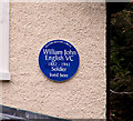
English VC plaque, Belfast
A plaque, on the King’s Road, commemorating William John English VC http://www.ulsterhistory.co.uk/englishvc.htm.
Image: © Albert Bridge
Taken: 18 Feb 2011
0.07 miles
3
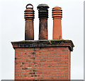
Chimney and chimney pots, Ballyhackamore, Belfast
A chimney, on the Sandown Road, with three capped pots. This was a suburban villa now converted to apartments.
Image: © Albert Bridge
Taken: 9 Sep 2013
0.07 miles
4
Weathervane and chimney pots, Ballyhackamore, Belfast
A weathervane and ornate chimney pots, on a former villa (now converted to apartments), on the Sandown Road.
Image: © Albert Bridge
Taken: 29 Apr 2014
0.08 miles
5
"Halkyn" rodding access cover, Belfast
A “Halkyn” rodding cover on the Sandown Road, close to Holland Park. Further information welcomed.
Image: © Albert Bridge
Taken: 24 May 2011
0.08 miles
6
Boarded-up house, Belfast
Vacant and boarded-up house on the eastern side of the Sandown Road, near the Comber Greenway
Image It has the appearance of a former gatehouse.
Image: © Albert Bridge
Taken: 8 Apr 2013
0.09 miles
7
Resurfacing of Sandown road Belfast
Metro bus number 18 on Sandown road at road works
The sign on the right is pointing to a new exclusive housing development on the site of the former guide dogs training school
Image: © John Thompson
Taken: 25 Sep 2014
0.10 miles
8
Pillar box, Belfast
GVIR pillar box on the Sandown Road, near Clara Park.
Image: © Albert Bridge
Taken: 1 Apr 2011
0.10 miles
9
No 86 Sandown Road, Belfast - November 2015(1)
The derelict house, now enclosed by fencing, seen from the north west.
Image: © Albert Bridge
Taken: 29 Nov 2015
0.10 miles
10
No 86 Sandown Road, Belfast - November 2015(2)
The derelict house, now enclosed by fencing, seen from the west.
Image: © Albert Bridge
Taken: 29 Nov 2015
0.10 miles


