
IMAGES TAKEN NEAR TO
Pembridge Mews, BELFAST, BT5 6HA
Introduction
This page details the photographs taken nearby to Pembridge Mews, BT5 6HA by members of the Geograph project.
The Geograph project started in 2005 with the aim of publishing, organising and preserving representative images for every square kilometre of Great Britain, Ireland and the Isle of Man.

There are currently over 7.5m images from over14,400 individuals and you can help contribute to the project by visiting https://www.geograph.org.uk
Image Map
Images are licensed for reuse under creativecommons.org/licenses/by-sa/2.0
Notes
- Clicking on the map will re-center to the selected point.
- The higher the marker number, the further away the image location is from the centre of the postcode.
Image Listing (90 Images Found)
Images are licensed for reuse under creativecommons.org/licenses/by-sa/2.0
Image
Details
Distance
1
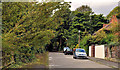
Sandown Park South, Belfast
Suburban cul-de-sac off the Sandown Road. The old railway (the Comber Greenway Image), close to the site of Neill’s Hill station Image, is behind the hedge on the left.
Image: © Albert Bridge
Taken: 5 Sep 2011
0.04 miles
2
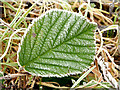
Frosty leaf, Belfast
There was quite a heavy frost overnight. This leaf is on the Comber Greenway.
Image: © Albert Bridge
Taken: 14 Jan 2014
0.04 miles
3
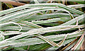
Frosty grass, Belfast
There was quite a heavy frost overnight. This frosty grass is on the Comber Greenway, near the Sandown Road.
Image: © Albert Bridge
Taken: 14 Jan 2014
0.04 miles
4
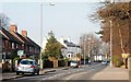
The Sandown Road, Belfast
The Sandown Road runs from the Knock Road to the Upper Newtownards Road at Ballyhackamore. The view is towards Ballyhackamore from near the old Neill’s Hill Station Image
Image: © Albert Bridge
Taken: 11 Feb 2008
0.04 miles
5
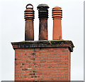
Chimney and chimney pots, Ballyhackamore, Belfast
A chimney, on the Sandown Road, with three capped pots. This was a suburban villa now converted to apartments.
Image: © Albert Bridge
Taken: 9 Sep 2013
0.05 miles
6
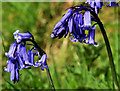
Bluebells, Belfast
Bluebells growing in the open, along the Comber Greenway, near the Sandown Road.
Image: © Albert Bridge
Taken: 21 Apr 2011
0.06 miles
7
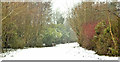
Snow, Comber Greenway, Belfast (March 2018)
The view from the Sandown Road, towards the North Road, at noon, as the snow was easing.
Image: © Albert Bridge
Taken: 3 Mar 2018
0.06 miles
8
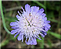
Scabious flower, Comber Greenway, Belfast (August 2016)
A blue flower, which I think is devil's-bit scabious http://www.habitas.org.uk/flora/species.asp?item=4352 , growing close to the Sandown Road entrance.
Image: © Albert Bridge
Taken: 5 Aug 2016
0.06 miles
9
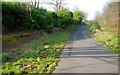
Former Neill's Hill station, Belfast (1)
Neill’s Hill was the next station after Bloomfield Image on the County Down line to Comber, Donaghadee and Newcastle. 58 years after closure the up platform survives (though mostly hidden by the bushes at middle left). The down platform has gone. The track is a path Image now renamed the “Comber Greenway”. Continue to Image
Image: © Albert Bridge
Taken: 11 Feb 2008
0.06 miles
10
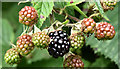
Blackberries, Comber Greenway, Belfast - August 2016(1)
Blackberries, between the Sandown and North Roads, in various shades from green to black, heralding the approach of autumn.
Image: © Albert Bridge
Taken: 5 Aug 2016
0.06 miles