1
Boarded-up house, Belfast
Vacant and boarded-up house on the eastern side of the Sandown Road, near the Comber Greenway
Image It has the appearance of a former gatehouse.
Image: © Albert Bridge
Taken: 8 Apr 2013
0.03 miles
2
Pillar box, Belfast
GVIR pillar box on the Sandown Road, near Clara Park.
Image: © Albert Bridge
Taken: 1 Apr 2011
0.03 miles
3
Resurfacing of Sandown road Belfast
Metro bus number 18 on Sandown road at road works
The sign on the right is pointing to a new exclusive housing development on the site of the former guide dogs training school
Image: © John Thompson
Taken: 25 Sep 2014
0.03 miles
4
No 86 Sandown Road, Belfast (August 2016)
The derelict house was demolished recently leaving this vacant site. Now offered for sale and described by the agent as “Full Planning Permission was granted on 14th April 2016 for a detached dwelling of c. 3,700 sq ft. We have drawings detailed in this brochure. Please contact the South Belfast office for further information. Please note that planning reference is Z/2014/1544/F”. This photograph appears as a matter of record only. I have no connection with any of the parties involved in the sale.
Image: © Albert Bridge
Taken: 5 Aug 2016
0.04 miles
5
No 86 Sandown Road, Belfast - November 2015(2)
The derelict house, now enclosed by fencing, seen from the west.
Image: © Albert Bridge
Taken: 29 Nov 2015
0.04 miles
6
No 86 Sandown Road, Belfast - November 2015(1)
The derelict house, now enclosed by fencing, seen from the north west.
Image: © Albert Bridge
Taken: 29 Nov 2015
0.04 miles
7
No 86 Sandown Road, Belfast (September 2018)
The first of two detached houses now under construction. The agent’s description includes “Situated in the Kings Road Conservation area, Ivy House is an exclusive development of two semi-detached family homes each with significant and beautifully appointed living space over 3 floors. These stunning homes extend to c.2,500 sq ft, each offering impressive spacious reception rooms with high ceilings and tall windows. The open plan kitchen and garden room create a superb free flowing space, ideal for modern family life. Each property features 5 double bedrooms and 3 stylish bathrooms. Externally the homes offer a large garden and private driveway with parking”.
I have no connection with the properties and cannot enter into correspondence.
Image: © Albert Bridge
Taken: 23 Sep 2018
0.04 miles
8
Former Neill's Hill level crossing, Belfast
See
Image The site of the level crossing on the Sandown Road. The view is towards Comber along what is now the Comber Greenway. Continue to
Image – January 2012.
Image: © Albert Bridge
Taken: 4 May 2010
0.04 miles
9
New Toucan crossing Sandown Road
New pedestrian Toucan crossing at the junction of the Sandown Road and the Start of the Comber Greenway.
This is the location of the disused Neills Hill railway station and level crossing
The project to improve the area also included the relocation of the bus stop on the right hand side of the photograph
Image: © John Thompson
Taken: 2 Dec 2014
0.05 miles
10
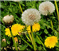
Dandelions, Belfast
Dandelions, in flower and seed, along the Comber Greenway, at the Sandown Road.
Image: © Albert Bridge
Taken: 8 Apr 2011
0.05 miles


