IMAGES TAKEN NEAR TO
Orangefield Avenue, BELFAST, BT5 6DJ

Introduction

This page details the photographs taken nearby to Orangefield Avenue, BT5 6DJ by members of the Geograph project.

The Geograph project started in 2005 with the aim of publishing, organising and preserving representative images for every square kilometre of Great Britain, Ireland and the Isle of Man.

There are currently over 7.5m images from over14,400 individuals and you can help contribute to the project by visiting https://www.geograph.org.uk

Image Map


Images are licensed for reuse under creativecommons.org/licenses/by-sa/2.0
Notes
  • Clicking on the map will re-center to the selected point.
  • The higher the marker number, the further away the image location is from the centre of the postcode.

Image Listing (68 Images Found)

Images are licensed for reuse under creativecommons.org/licenses/by-sa/2.0
  • ...
Image
Details
Distance
1
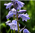
Bluebells, Belfast
Bluebells were quite common today along the Greenway, both in the open and under the trees. This is part of a clump between the North Road and the Sandown Road.
Image: © Albert Bridge Taken: 28 Apr 2012
0.08 miles
2
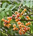
Rowan berries, Comber Greenway, Belfast (August 2016)
Berries, on a rowan tree, between the Sandown and North Roads.
Image: © Albert Bridge Taken: 5 Aug 2016
0.08 miles
3
Buddleia, Belfast
There is a profuse growth of buddleia, along the Comber Greenway, between the Sandown and North Roads. This was one of the few still in flower.
Image: © Albert Bridge Taken: 9 Sep 2013
0.09 miles
4
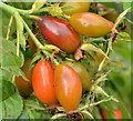
Rosehips, Belfast
Maturing rosehips growing along the Comber Greenway, between the Sandown and North Roads.
Image: © Albert Bridge Taken: 9 Sep 2013
0.09 miles
5
Puddle, Comber Greenway, Belfast
The Comber Greenway is a path along the old Belfast and County Down railway. With the heavy rain over the last few days I expected the path (in a cutting) to be wet. In fact this was the worst, between the Sandown and North Roads, near the former Neill’s Hill station Image Not deep.
Image: © Albert Bridge Taken: 5 Jan 2012
0.09 miles
6
Old railway, Belfast (2)
See Image The old line further east.
Image: © Albert Bridge Taken: 11 Feb 2008
0.09 miles
7
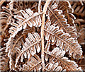
Frosty bracken, Belfast
There was quite a heavy frost overnight. This bracken is beside the Comber Greenway.
Image: © Albert Bridge Taken: 14 Jan 2014
0.09 miles
8
Memorial, Comber Greenway, Belfast
A memorial beside the Comber Greenway, between the Sandown and North Roads, in memory of one who died there on 15 September 2012.
Image: © Albert Bridge Taken: 8 Apr 2013
0.09 miles
9
The Orangefield Road, Belfast (2)
See Image Much further east along the road, looking towards the Sandown Road from the corner of Orangefield Grove, where more traffic calming measures are used. The Orangefield Road and its continuation, Sandhill Gardens, run almost in a straight line, for more than half a mile.
Image: © Albert Bridge Taken: 21 Apr 2011
0.09 miles
10
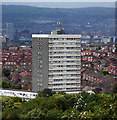
Clarawood House, Belfast
15-storey tower block located at the end of Clara Way in Belfast. The tower, completed in 1967 by local firm F.B. McKee, is 44 metres tall and contains 57 flats. It is part of the Clarawood estate, built in the late 1940s by the Belfast Corporation, although this is the only tower block in the development. The view is from Knock Burial Ground (Knockmount Park).
Image: © Rossographer Taken: 11 Sep 2011
0.10 miles
  • ...